The British Empire under George V
During the 19th century, the rose-red British Empire was characterised by its pursuit of raw materials for industry and the creation of markets for its manufactured goods. Congruently, it also required the establishment of strategic naval bases and supply stations around the world. This map reflects the belief in the superiority of European nations and their institutions, and that other nations can benefit from their influence.
The popular flag card, commemorating King George V’s silver jubilee, also displays the colonies acquired during the Berlin Colonial Conference of 1884-’85, during which Africa was further divided. The British flag prominently covers a region from Cape Town to Cairo, with Tanganyika depicted as a mandate territory and Egypt as a protectorate.
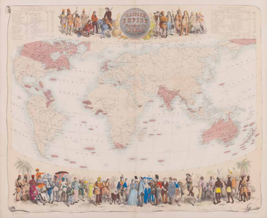
J. Bartholomew, British Empire Throughout the World Exhibited in One View, Edinburgh, London & Dublin ±1860. Coll. S/T U.9d.54, 52 x 62.5 cm.
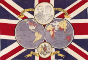
Anonymous, Twenty-Fifth Anniversary 1910-1935, (London) 1935. Coll. S/T W.9e.112, 58 x 82.5 cm.