D-day: Atlantic Wall breached
Just as travellers in a car hold a map in the direction they are headed, this map is oriented toward the beach, which is to the south. Based on intelligence efforts, the troops are aware of the obstacles they will encounter both on the way to the beach and on the beach itself, including anti tank barriers known as “hedgehogs” and landmines. Despite having this information, the battle from the beach upward takes a significant toll on the attacking forces.
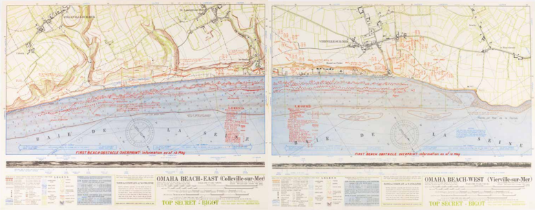
Anonymous, Omaha Beach-East (Colleville-sur-Mer) & Omaha Beach-West (Vierville-sur-Mer), z.p. z.j., (overprint, original April-May 1944). Coll. S/T Y.1e.1, 50 x 128 cm.