‘Modernisation’ of the natural Rhine
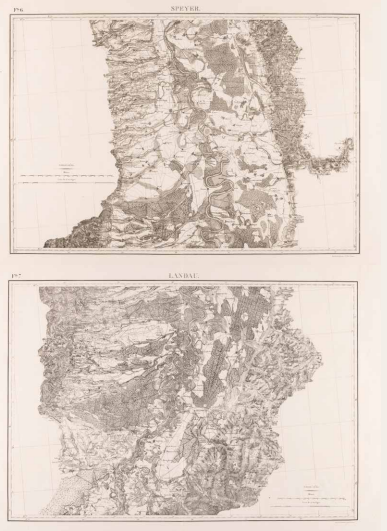
Before modern times, the length of the Rhine is about twice as long as a straight line from city to city: the river meanders considerably and flows slowly. As a result, it offers a great deal of storage capacity, especially with so many spacious floodplains and dykes far away from the river. However, those floodplains are teeming with cutoffs and riparian forests. In the early 19th century, this made the Upper Rhine almost entirely unsuitable for transport. The slow flow causes silting and recurring (ice) blockages. Humans intervened: the river is straightened (as executed at the Neckar estuary on sheet 6) and depth is increased using groynes. However, this caused the Rhine to ’empty out’, making Basel inaccessible. France builds a parallel canal (further south) that reduces the Rhine to a drying stream, like the Grensmaas in Limburg today. The river is regularised for transport and irrigation, and little remains of nature.

War Depot, Path of the Rhine from Constance to Nijmegen extracted from topographic maps of former Swabia and United Departments, drawn by officers of the Geographical Engineer Corps 1801–1814 by order of Lieutenant -General Pelet, folio 6 (Speyer) & 7 (Landau)), Paris 1836. Coll. S/T F.87, (2x) 72 x 102 cm.
