The power of the swelling Rhine
During periods of high water levels in the Rhine, the river valley experiences inundation. This flooding highlights the size of the valley, despite the protective dikes built along it for centuries. The changing climate and the loss of upstream catchment basins cause larger volumes of water to occasionally flow through the Rhine, prompting the river to reclaim the same expanses of land depicted on this map.
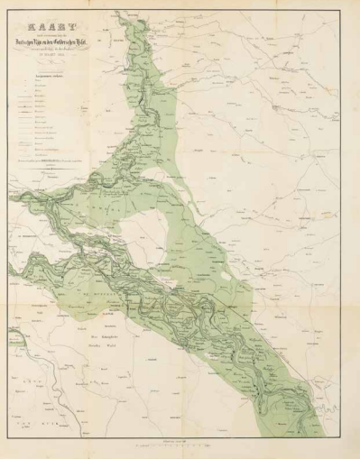
L.A.J.W. baron Sloet, H.F. Fijnje, G.J. Thieme, Map of the inundation along the Duitschen Rijn and Gelderschen IJssel caused by the breaches in March 1855, Arnhem 1856, from: Description of the flood in Gelderland in March 1855. Coll. S/T T.172, 71 x 56 cm.