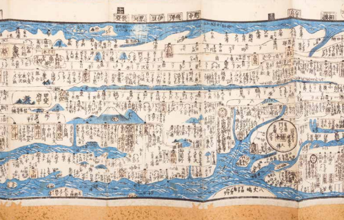
Safe travel navigating by the constellations: Japan
This hand-tinted map was originally harmonica-folded but has been pasted and fitted with sidebars for the purpose of protection. You can see mid-19th century Japan, shortly before American gunboat diplomacy forced the country out of its isolation. This is a ‘dochuzu’, a road map with compass indications for landlords, soldiers, merchants, and pilgrims, with indications of when to travel safely based on the position of the stars. The map is packed with information on, for example. boat trips along the east coast, postal routes with tolls, and inns where horses can be changed. Cities are highlighted, with temples and pagodas, Edo (Tokyo) lies to the right and sacred Mount Fuji to the left. For the Western eye, an elongated map like this is difficult to make sense of. It doesn’t rely on Western scale, but distances in length are correct, comparable to the Peutinger map of the Roman Empire. It appears the topographic map as already used in the west (and soon also Japan) is not the only way to read routes spatially.

I. Izumiya & H.Yamasaki, (travel map of Japan), Tokyo 1846-’50. Coll S/T U.3j.23, 28 x 794 cm.
