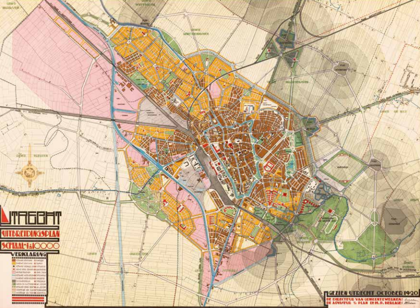
Waterline hinders expansion of Utrecht
Hein Berlage is commissioned to design an expansion plan for Utrecht, together with director of Public Works L.N. Holsboer. At the time, Berlage has become renowned as an acclaimed urban planner. Utrecht is located near the Nieuwe Hollandse Waterlinie, an 85-kilometre stretch of forts, castles, and strongholds. The duo takes the forts’ line of fire (see the grey circles) into account. By necessity, they plan urban expansion to the north and west. In an area where building is not permitted, they plan a national airport: the green-bordered diamond near fort Hoofddijk. An Amsterdam-based lobby prevents an airport from being built. A ring road along the forts is also not realised, following objections from the Ministry of War. The football stadium where FC Utrecht plays to this day, however, is realised. Based on the plan, the Oog in Al and Overvecht districts and an industrial zone to the northwest are realised. The duo design parks and shady avenues with long rows of trees, long before heat stress and climate change made such elements an absolute necessity. After 19thcentury revolutionary treeless construction, no city can go without greenery.

Holsboer & Berlage, Expansion plan Utrecht, Utrecht 1920. Coll. S/T V.788, 81 x 108.5 cm.
