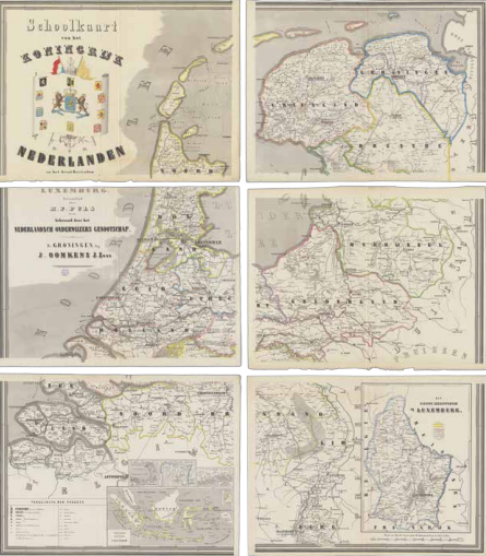
Wall map of the Kingdom
During the mid-19th century, the wall map made its appearance in the classroom. These hand-coloured maps depict 11 provinces, complete with the provincial and district capitals, smaller towns, villages, hamlets, as well as the country’s network of waterways and railways. The map also displays the Dutch colonies and the Grand Duchy of Luxembourg, which formed a personal union with the Netherlands until 1890.

H.F. Puls, Map of the Kingdom of the Netherlands and the Grand Duchy of Luxembourg (awarded by the Nederlandsch Onderwijzers Genootschap), six sheets, Groningen 1860. On loan from UBL, CollBN port 4 N 12, ± 180 x 170 cm.
