Allied and German trenches
This secret map (1:20,000) from September 1918 is overlaid with German (blue) and allied (red) trenches and therefore it may not be used at the front. When Germany cleared fifty Eastern Front divisions after the Russian revolution and rapidly moved them to the Western Front, General Ludendorff managed to conquer large areas of France with a spring offensive. However, his plan to take Ypres and drive the British troops across the channel failed. The Allies, in turn, had to give up Passchendaele and Messines again to shorten their front line. The arrival of large numbers of American GIs causes morale among German troops to drop. Under the leadership of Marshal Foch, a major counteroffensive is launched on a broad front from 8 August. At Ypres, the attack was launched by twelve Belgian, ten British and six French divisions. On 28 September, the German army had to give up Langemarck, where it had been stationed for four years.
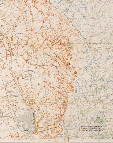
Service Topographique de l’Armée Belge, Plan Directeur Ypres (Belgian Army Topographic Service, Ypres Master Plan), z.p. 1918. Coll. S/T W.1a.129, 64 x 103 cm.