Kingdom of Prussia
Framed within light blue borders, this survey map featured in the Atlas des Königreichs Preussen provides a representation of the Prussian Empire following the Congress of Vienna in 1815. This map illustrates how Prussia extended its territorial control over large portions of western Germany during this period.
To avoid any potential confusion, an image of a similar map from the Preussen-Atlas is presented alongside, spanning the years 1815 to 1861, depicting the . This map offers a step-by-step depiction of Prussia’s territorial expansions, within its open-ended pages.
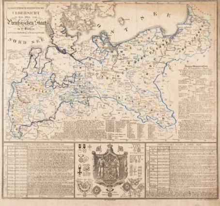
Prem. Lieut. Blume, Geographisch-Statistische Uebersicht zu dem Atlas vom Preussischen Staat, from: Atlas des Königreichs Preussen in siebenundzwanzig Blättern, Erfurt 1831. Coll. S/T F.11, 50 x 60 cm.
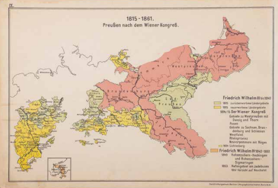
I. Mück, 1815 - 1861 Preussen nach dem Wiener Kongress, in: Preussen-Atlas. Kartenbildliche Darstellung von Preussens Wachstum mit geschichtliche Erläuterungen, Berlin 1914. Coll. S/T J.61, 23.5 x 71 cm.