Military-topographical map
In 1854, the Peel was still 75 km long and ± 15 km wide; a landscape with heathland, sand dunes, a lot of liquid soil and bog (raised bog), and shallow pools. People started making this ‘onland’ productive by digging canals for drainage and transporting black peat. In 1921, halfway between Deurne and Venray, the government establishes the symmetrical model reclamation village of IJsselsteyn. Peel inhabitants are also modernised. Marginal ‘half savages’ (smuggling, poaching, drinking, and fighting) are to develop the ‘vigorous and healthy life’ here as ‘new farmers’.
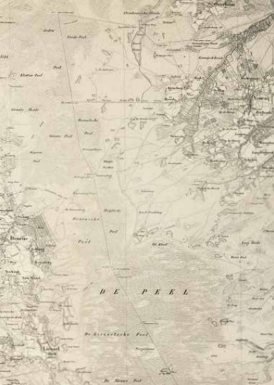
Topographic Bureau of the Ministry of War, Topographic and Military Map of the Kingdom of the Netherlands, sheet 52 Venlo, ('s Gravenhage) 1854. Coll. S/T F.96, 70 x 115.5 cm.
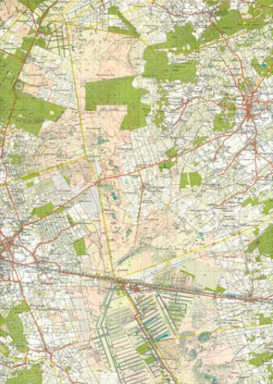
Ministry of Defence, Topographical Service, Topographical Map of the Netherlands, sheet 52 W/O (Venlo West/Venlo Oost), s.p. 1937. Coll. S/T K.118, 2 sheets 50 x 40 cm.