Soviet maps of Dutch cities
Immediately after World War II, Stalin orders the world and all countries and relevant cities to be mapped. It is the largest cartographic project ever. Almost all larger Dutch cities are mapped in scales 1:10,000 or 1:25,000. The maps are still ‘secretno’, secret in Russia. Dordrecht and Maastricht are depicted with military-relevant information: barracks, government buildings, military industry. It is fascinating that the Soviets mention trees along dykes (not on public Dutch maps at the time), omit tunnels, because not passable for tanks, and interpret aerial shots of pipelines under construction as roads, which are therefore not there. Mention of carrying capacity of bridges underscores that the maps are intended for the Red Army to take Western Europe with tanks. In Maastricht, the ENCI and even pottery factories are apparently militarily important.
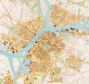
Генеральный Штаб (General Staff (of the Soviet Army)), Дордрехт (Dordrecht), (Moskwa) 1981. Coll. S/T V.1639, 87.5 x 95.5 cm.
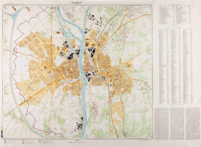
Генеральный Штаб (General Staff (of the Soviet Army)), Маастрихт (Maastricht), (Moskwa) 1980. Coll. S/T V.2086, 86 x 118 cm.