Official map of the Suez Canal
This rare chromolithographic map of a waterway without locks (the thick red line) through the isthmus between Port Saïd and Suez appears three years before the grand opening of the Suez Canal. A publication of the responsible joint-stock company,it is intended to promote the modern mega-project and is to be gifted to major shareholders and directors. A smaller canal including locks (the thin red line) runs from Cairo via Ismaïlia to Suez and acts mainly as a supply line of fresh water for canal workers and for concrete production. Railway lines, such as the connection between Cairo and
Suez, are indicated with black lines. Insets of Port Saïd, Ismaïlia and Suez show their port extensions. Of the profile inserts, the one at the bottom stands out, a sophisticatedly designed geological cross-section from the Mediterranean to the Red Sea with 11 soil types in different colours. This Suez Canal shortens the connection between Britain and India by as much as 9,000 kilometres.
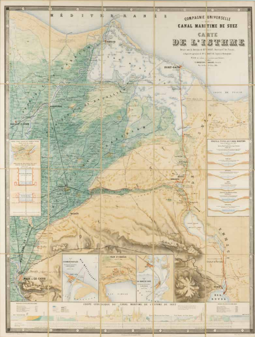
Compagnie Universelle du Canal Maritime de Suez, Carte de l’Isthme (Map of the Isthmus), Paris 1866. Coll. S/T U.6f.1, 115 x 90 cm.