The Warsaw ghetto
Around November 12, 1940, ‘SSSturmbannführer’ Max Jesuiter traces the area for a new Jewish ghetto on a secret military map of Warsaw, in purple pencil. The plan stems from an ordinance by the German governor, but the erratic borders result from quarrels between Jews and Poles over living space allocated to them. On November 16, the ghetto is closed off, and residents can only leave at specified times, with special work passes. Gates are guarded by German gendarmerie and Polish police, and Jewish police operate within. The ghetto for some 400,000 Jews corresponds almost entirely to the SS plan. Forced resettlement of 113,000 Christian Poles against 138,000 Jewish Poles makes conflict between Jews and Poles even more grim. And this is just the initial phase of the ghetto. In his diary, ghetto inhabitant Chaim Kaplan writes: “We are trapped within a double wall: a brick wall for our bodies and a wall of silence for our souls.”
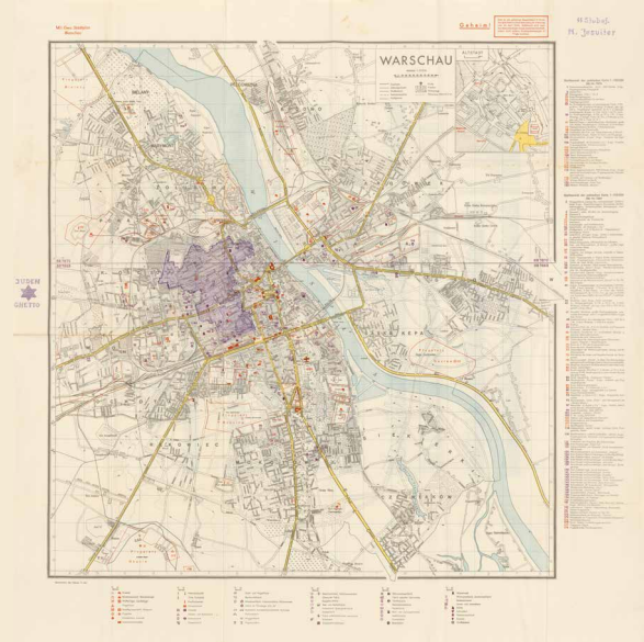
Generalstab des Heeres, 9. Abt, Mil. Geo. Stadtplan Warschau (Military-Geographic city map of Warsaw) / M. Jesuiter, Judenghetto (Jewish ghetto), Berlin (1939)/ Warschau 1940. Coll. S/T W.2t.92, 102 x 97.5 cm.