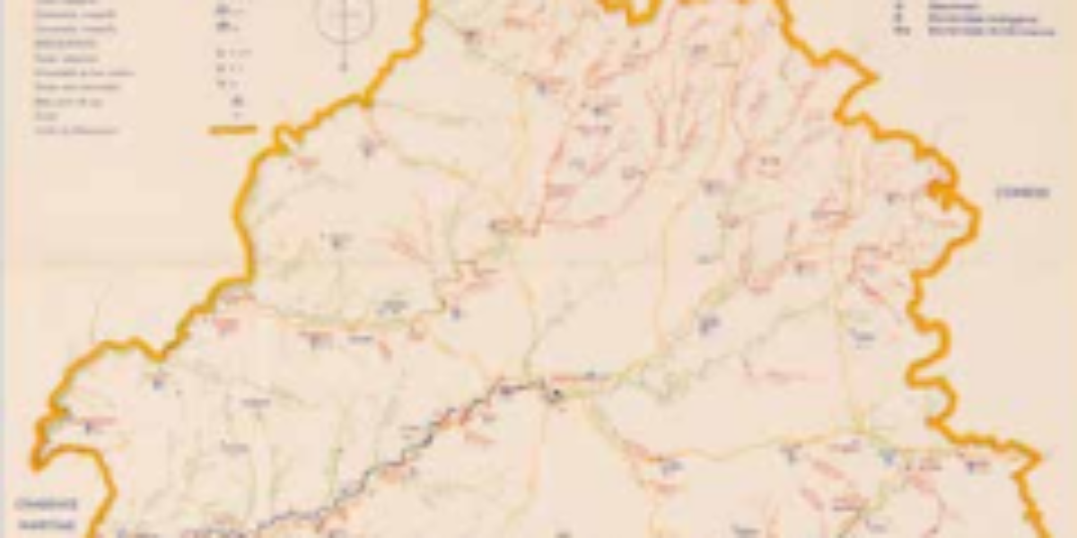
Mass expulsion of German losers
This wall map of Germany provides a visual representation of the country’s 1937 borders, with the Federal Republic in green. The school map depicts the largest European migration of people in the 20th century. The term ‘Heimatvertriebenen’ refers to the German-speaking ethnic minorities ‘cleansed’ from Central and Eastern Europe, as well as the German nationals expelled from the eastern provinces annexed by Poland and the Soviet Union between 1945 and 1955.
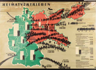
Schropp'sche Landkarten und Lehrmittel-Anstalt (ed.), Heimatvertriebenen (Mensch und Weltbild, Tafel 10), (Hamburg 1955). Coll. S/T W.1c.932, 85.5 x 133.5 cm.
More chapters
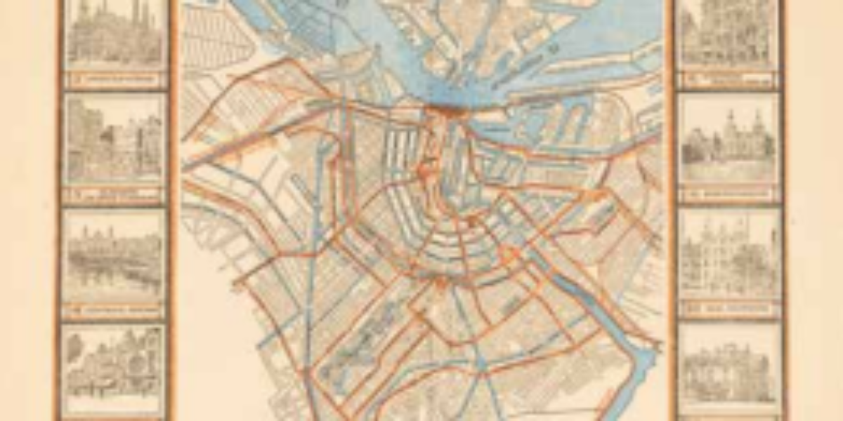
1. Itineraire des Routes
Travel Atlas to Amsterdam This survey map depicts the Kingdom of Holland, complete with land and water routes from Amsterdam, which wasn’t officially designated as the capital until 1808. At this point, Zeeuws-Vlaanderen and Limburg remained under French rule. The Meuse River serves as the northern border of the department of Brabant (encompassing Heusden, Woudrichem,…
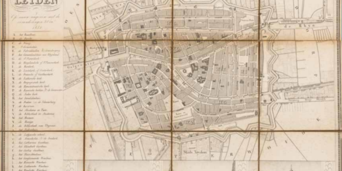
2. Plattegrond der stad Leyden
Leiden as an early tourist attraction This ancient folding map of Leiden serves as a guide for travellers. Notable attractions include the City Hall (A) with its tall tower, resembling a museum adorned with paintings and tapestries. High-end tourists are drawn to landmarks like the University Library featuring the Anatomical Theatre (V), as well as…
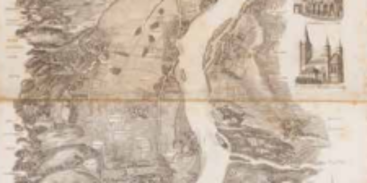
3. Panorama du Rhin
Mass tourism begins on the Rhine During the Napoleonic Wars, the Middle Rhine is already no longer seen as a border, but the romantic subject of German song. After Waterloo, English painters such as Turner and poets such as Lord Byron create legendary impressions of the Rhine in images and words. In May 1827, two…
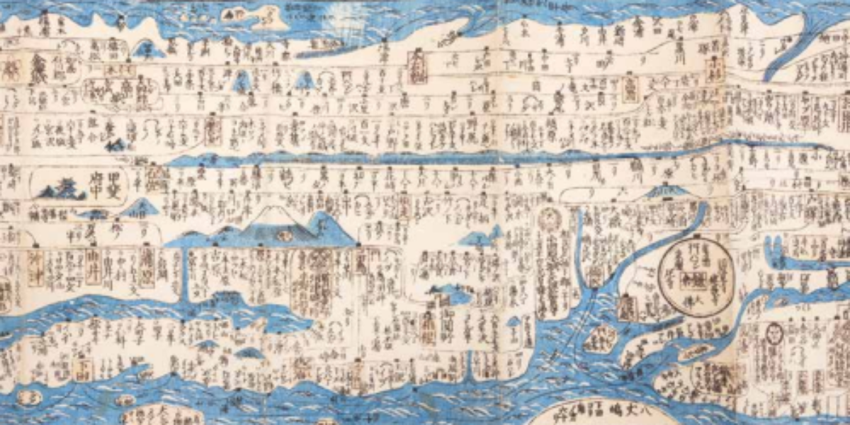
4. Travel map of Japan
Safe travel navigating by the constellations: Japan This hand-tinted map was originally harmonica-folded but has been pasted and fitted with sidebars for the purpose of protection. You can see mid-19th century Japan, shortly before American gunboat diplomacy forced the country out of its isolation. This is a ‘dochuzu’, a road map with compass indications for…
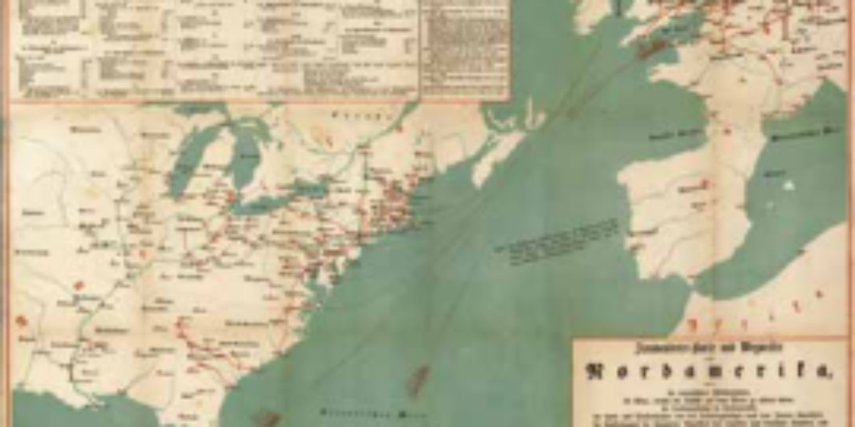
5. Auswanderer-Karte
European migration to Land of Freedom This German map illustrates the emigration of peasants, artisans, and Jewish refugees from Eastern Europe to North America in the mid-19th century. Following the unsuccessful liberal revolution of 1848-49, which aimed to transform the confederate German Confederation into a democratic German Empire, disillusioned citizens sought opportunities in “the land…
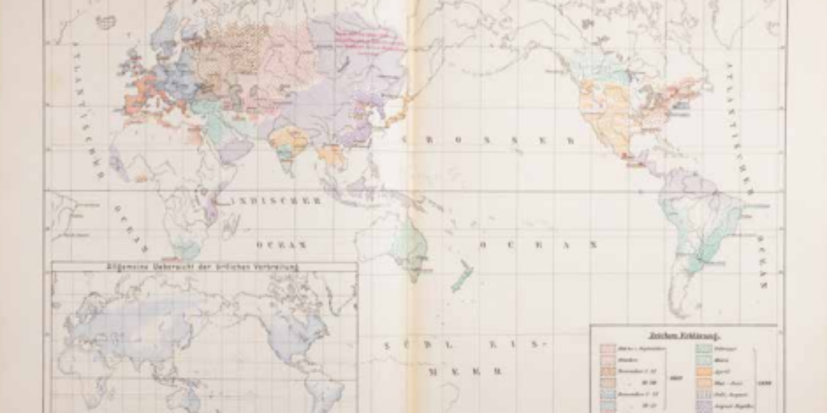
6. Influenza-Pandemie
The first Corona pandemic? Not only people and animals travel around the world – germs do, too. In May 1889, doctors discover a mysterious lung disease in Bukhara (Central Asia). Pneumonia and headaches are the main symptoms, and some patients also complain of loss of taste and smell and extreme fatigue. In the first months,…
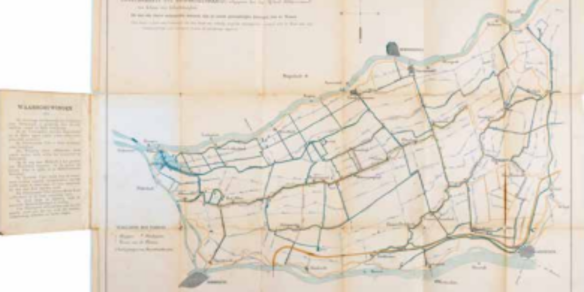
7. Alblasserwaard
Skating sport as provision of work Ice roads are accessible for only a few weeks each year. They serve as alternative transport routes for businesses when ships can no longer sail due to frost. Unemployed individuals are employed to keep the routes skatable. The map also considers tourist skaters, with marked jetties for boat services…
8. République Argentine
Successful travel guide plagiarised Beginning in the 1930s, international publishers such as Murray and Baedeker gained popularity in the Western market with their “quick traveller’s guides.” Baedekers became so popular that Alberto Martinez illegally copied their model. His voluminous Baedeker of the Republic of Argentina for tourists and business travellers includes photographs, statistical tables, and…
9. Camp des internés
Belgians‘ forgotten mass flight Following the fall of Antwerp in October 1914, Belgian civilians and soldiers flee en-masse to the Netherlands. Their numbers swelled to over 1 million. The soldiers are placed in internment camps, and one of the largest camps, with capacity for 15,000 soldiers, is located near Harderwijk. Many soldiers successfully escaped from…
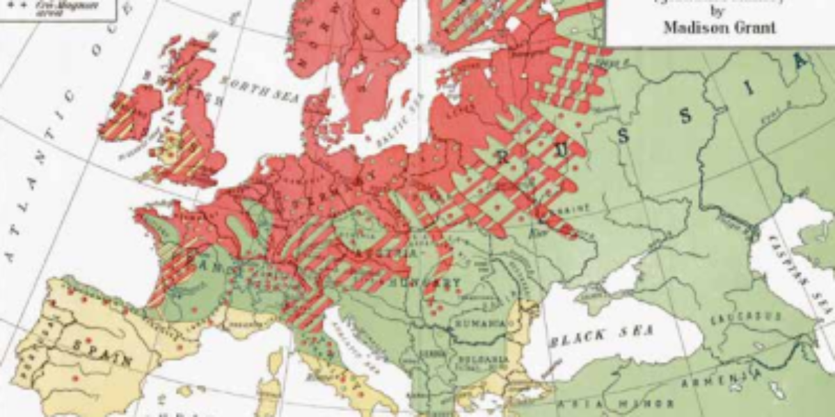
10. European Races
Racism as basis for immigration selection In this ‘popular science’ book, Madison Grant, a lawyer, conservationist, and eugenicist, puts forth the argument that Europeans are biologically and culturally superior to Asians and Africans. He argues for the existence of a natural hierarchy of races even within Europe. Grant advocates to restrict immigration from what he…
11. Olympiad 1928
Tourism success with Olympics Since the inception of the ‘modern’ Olympics in 1896, the Games have consistently proven to be a major tourist attraction for the host countries. Despite the rising costs associated with hosting the event, city governments continue to eagerly organise the Summer Games as a means of showcasing their city on the…
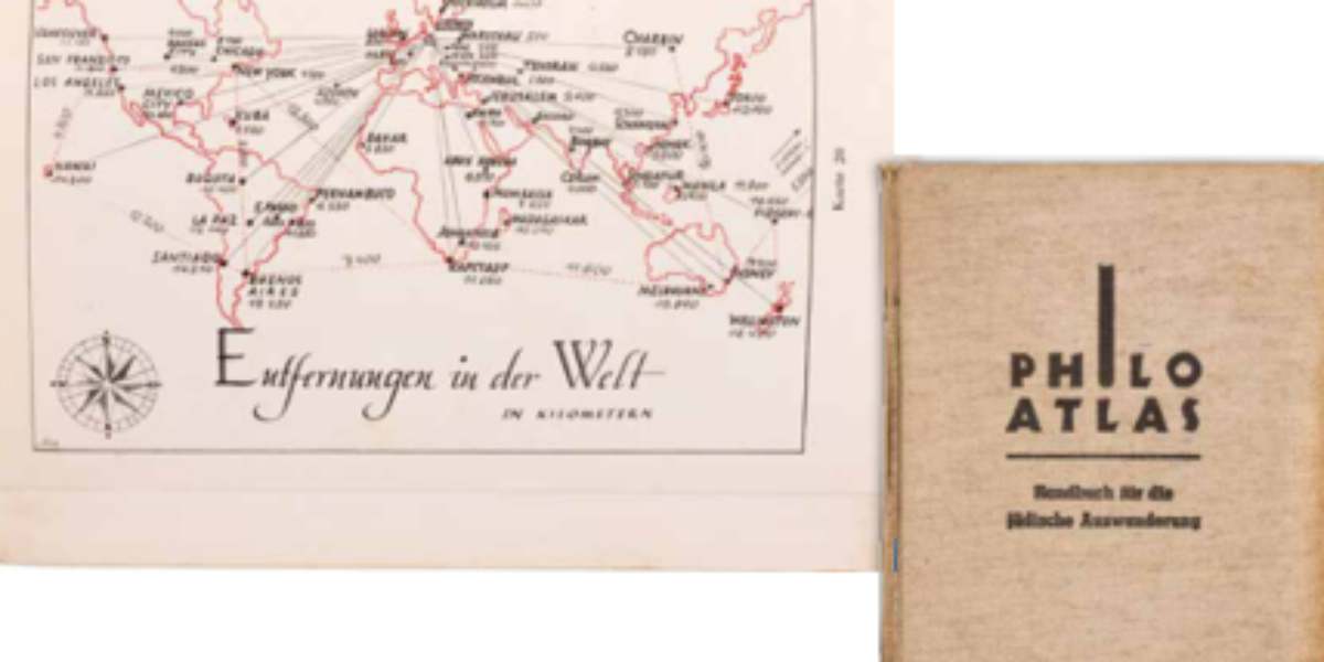
12. Philo-Atlas
Handbook for desperate Jewish emigrants Occurring simultaneously with Kristallnacht (9th and 10th November, 1938), Berlin published this Handbook of Jewish Emigration. The guide contains an alphabetical list of countries with their professional opportunities and visa rules. But in this instance these details are not merely tourist formalities, but necessary information for survival. Which countries are…
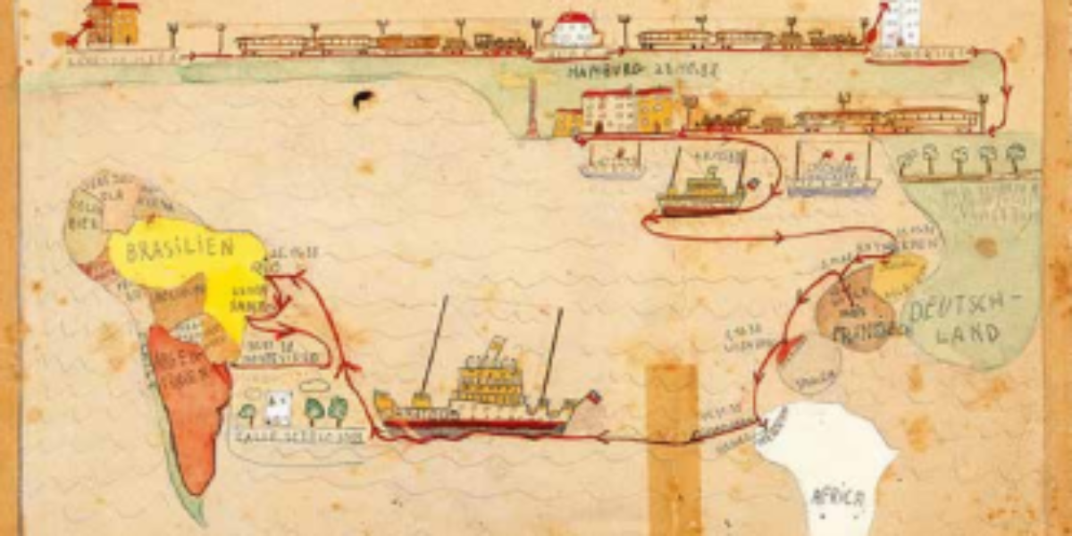
13. Neuen Heimat
Successful flight through children’s eyes In the late months of 1938, the Freudenheim family managed to escape from Berlin. Amidst this journey, their 11-year-old son, Fritz, chronicles the various homes his Jewish family had occupied since 1925, tracing their voyage across the Atlantic: From the old homeland to the new homeland! After a six-week odyssey,…
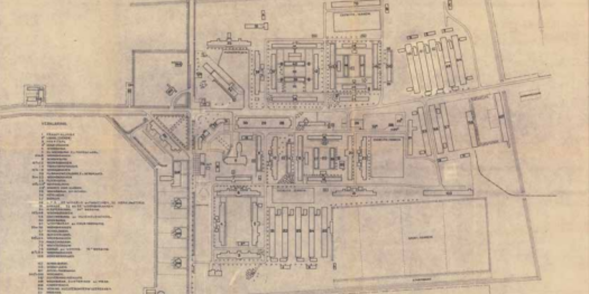
14. Camp Schattenberg
Nothing as permanent as temporary migration In 1951, the Moluccans, who had served in the Royal Dutch East Indies Army, found themselves ‘temporarily repatriated’ to the Netherlands, despite most of them having never previously been to the country before. Many of them ended up at Camp Westerbork, which was renamed Camp Schattenberg for this occasion….
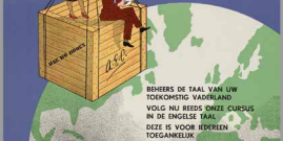
16. Emigrating is looking forward
Netherlands emigration country, for a while In addition to the ‘Christian Emigration Central’ and the ‘Catholic Emigration Foundation’, the ‘General Emigration Central’ is a federation of social organisations that mediates for Dutch nationals who want to continue their lives elsewhere. This government-subsidised organisation helps find work overseas, as well as setting up retraining and language…
17. Carte Piscicole
Fish tourism saves rural economy One of the attractions of the French Dordogne is its sport fishing, which this map shows in detail. Sports fishing associations can check various forms of compliance based on the information in this map. The rivers in the region are disrupted by numerous dams, referred to as ‘barrages.’, and due…
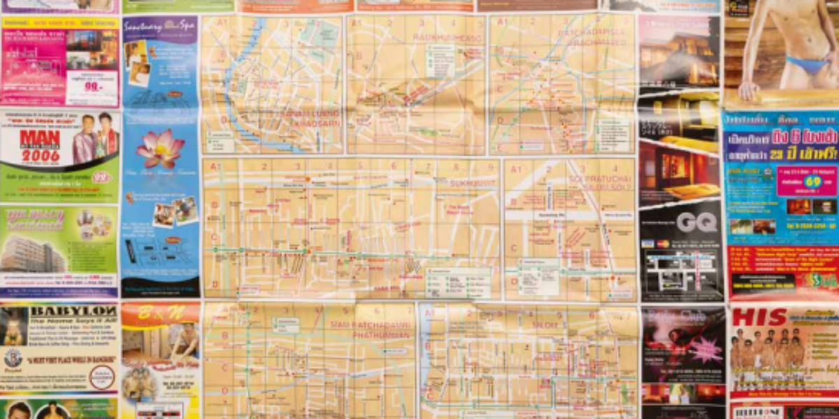
18. Gay Guide
Sex tourism: source of exploitation Outside of Europe, the nations of Thailand, the Philippines, Brazil and the Gambia are havens of sex tourism. This Gay-Guide of Bangkok (complete with advertisements and a city map) promotes Thai young men who willingly and openly sell their sexual services to male tourists from rich countries. Although legal, this…
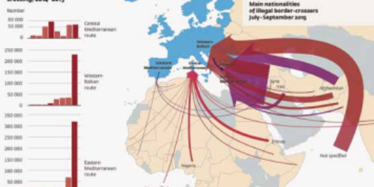
19a,b. Illegal border-crossers
Unwanted and deadly migration This remarkable map produced by the European Border and Coastguard Agency presents the flows of illegal migrants en route to Europe. The thick flowing red and purple arrows, representing a ceaseless flow of millions of people, seems to suggest an invasion against which Europeans must defend themselves. In contrast, an alternative…
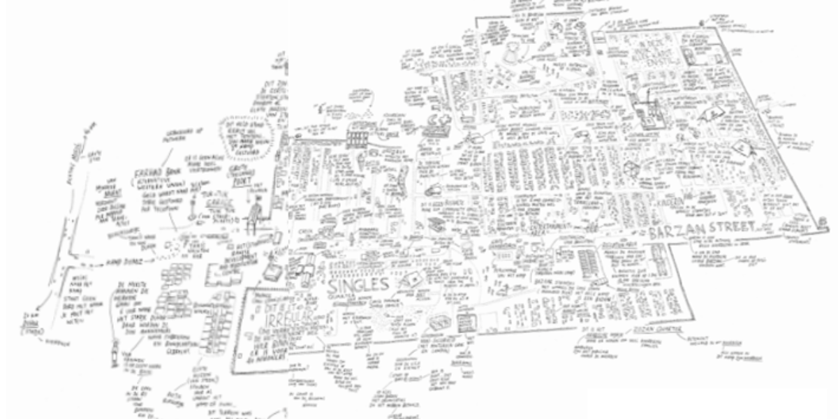
20. Refugee Republic
Refugee camp as a city in the making Camp Domiz in northern Iraq is home to nearly 60,000 Syrian Kurds who have fled. They expected to return soon, but most of them have been there for years. The camp has twelve neighbourhoods packed with tent houses, two hospitals and seven schools. The community abides by…