Paris: modernity versus revolution
On the initiative of Napoleon III, France’s last monarch, Georges-Eugène Hausmann, capital prefect, modernises the Paris urban structure and street layout. Napoleon III personally sketches the designs for this. At the time of this map’s publication (1867), the work is largely complete. The city is seen as a living organism where the lifeblood of mobility must be able to flow freely: perhaps that’s why new streets are coloured red? Entire blocks of houses are expropriated to allow breakthroughs and large-scale beautification of buildings. It’s not all about aesthetics, though: being able to quell barricade uprisings in working-class neighbourhoods is an equally important consideration. Boulevard Richard-Lenoire, for instance, was used to overarch the Canal Saint-Martin, which was still the ‘natural’ line of defence for insurgents in 1848. ‘La ville lumière’ (the enlightened city) is the French interpretation of ‘enlightenment’. Napoleon III saw the city as the new Rome. Its apotheosis: twelve boulevards converging at the Arc de Triomphe.
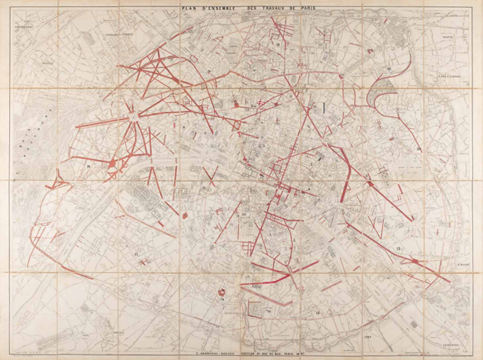
E. Andriveau-Goujon, Plan d’ensemble des travaux de Paris (Overall plan of Paris works), Paris 1867. Coll. S/T U.1f.105, 98.5 x 131 cm.