Schoolwandkaart van Nederland
At the end of the 19th century, the development of lithography makes it possible to print coloured surfaces. On this school map by head teacher C.A.C. Kruyder from Zwolle, the sea is green, and the land is black. The dark, ominous look of this wall map is illuminated to some extent by dotting provincial boundaries white, depicting rivers and lakes in light green, and marking railroads in red and cities in yellow. The main map is a ‘blind map’ for the students in the class – names are on the insert card at the bottom right as a reminder for the teacher. Such school maps are indispensable for the formation of a national identity. Through frequent repetition of national maps of all shapes and sizes, spatial division of countries by political authority becomes self-evident and borders between states become ‘second nature’.
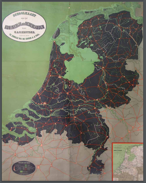
C.A.C. Kruyder, Schoolkaart van het Koninkrijk der Nederlanden (School map of the Kingdom of the Netherlands) , Zwolle 1905. Collection ‘De Wereld aan de Wand’ (The World on the Wall), 176 x 149 cm.