Language map of Germany
In 1834, Karl Bernhardi, librarian in Kassel, suggests the creation of a language map of the German nation to national historical
societies. In romantic nationalism, a people’s history largely determines the development of their national consciousness, and cultural unity can be seen in a common language more than anything else. After nine years of collecting data from regional experts, Bernhardi manages to delineate Germany’s borders in orange-red, relative to the languages of its neighbours (French, Italian, Danish, Hungarian, and “Slavic” have different colours). Germanic enclaves outside the German Confederation are listed separately on the map, as well as internal borders of regional dialects (including Dutch). The patriot Bernhardi presents with this map his vision of the future Germany, thus representing his geopolitical idea of the nation.
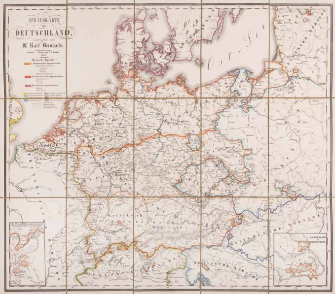
K. Berhardi, Sprachkarte von Deutschland (Language map of Germany), Kassel 1843. Coll. S/T U.1c.89, 52 x 59 cm.