Manchester cotton capital
This 1829 map of Manchester is divided into circles, which in turn are divided into smaller sections. The centre is formed by the
Textile Exchange, even though it is not at the centre. With alphabetically arranged sectors and a separate list of names, streets can be found quickly on this modern and functional map. In the early 19th century, Manchester expanded rapidly due to a massive influx of Scots, Irish, Welshmen and English. This first industrial city was also called Cottonopolis. Engineering firms designing cotton machinery widened their offerings. The chemical industry, started to produce bleaches and dyes, also expands into other fields of work. Although modern steam engines replace the old water mills, public waterways, with loading and unloading docks and private canals for supply and discharge of industrial water, play an important role in the city. The railway line to Liverpool is missing here, opening only a year later.
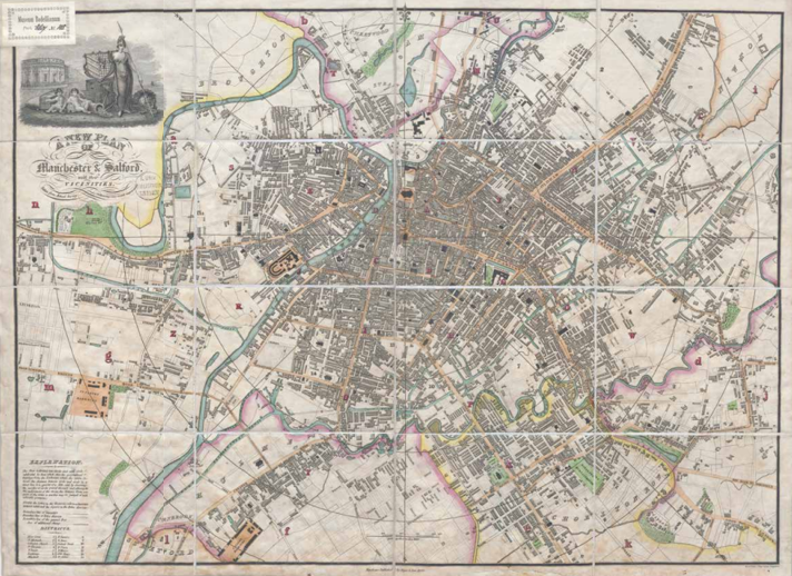
J. Pigot & Son, Plan of Manchester & Salford with their vicinities, Manchester 1829. On loan from UBL, CollBN 011-15-090, 39.5 x 54.5 cm.