Melting roof of Europe
Many of the extensive glaciers depicted on this late 19th-century Alpine map, represented by the blue fields, have disappeared altogether, as evidenced by the Zapport Glacier (2b). During a dry summer, 20% of the Rhine’s flow comes from glacier meltwater, but what will happen in the future as glaciers continue to retreat or disappear completely?
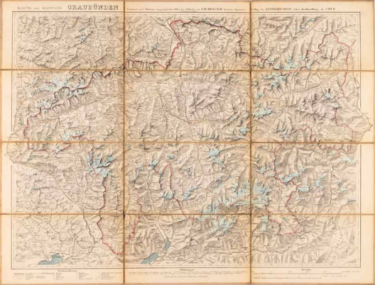
G.W. Mengold, Karte des Kantons Graubünden, Reduziert nach Dufour's topographischem Atlas der Schweiz, Chur 1875. Coll. S/T U.2s.14, 49 x 64.5 cm.
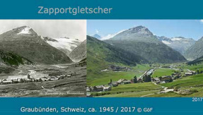
Gesellschaft für Ekologische Forschung, Zapportgletscher, Graubünden, Schweiz, 1905-2017, (Munich) 2017.
More chapters
1. Altitudes
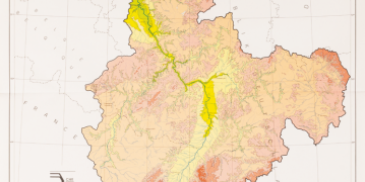
The Rhine River basin This elevation map of the Rhine River basin still shows national boundaries, but from a water management perspective, we need to look at the entire river basin. The Netherlands is heavily dependent on Rhine water, when it comes to quantity as well as quality. The melting of Swiss glaciers affects the…
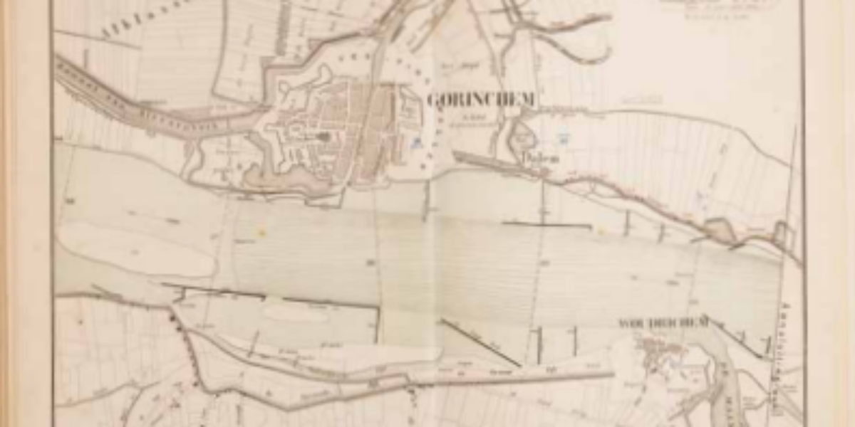
3. Cours du Rhin
‘Modernisation’ of the natural Rhine Before modern times, the length of the Rhine is about twice as long as a straight line from city to city: the river meanders considerably and flows slowly. As a result, it offers a great deal of storage capacity, especially with so many spacious floodplains and dykes far away from…
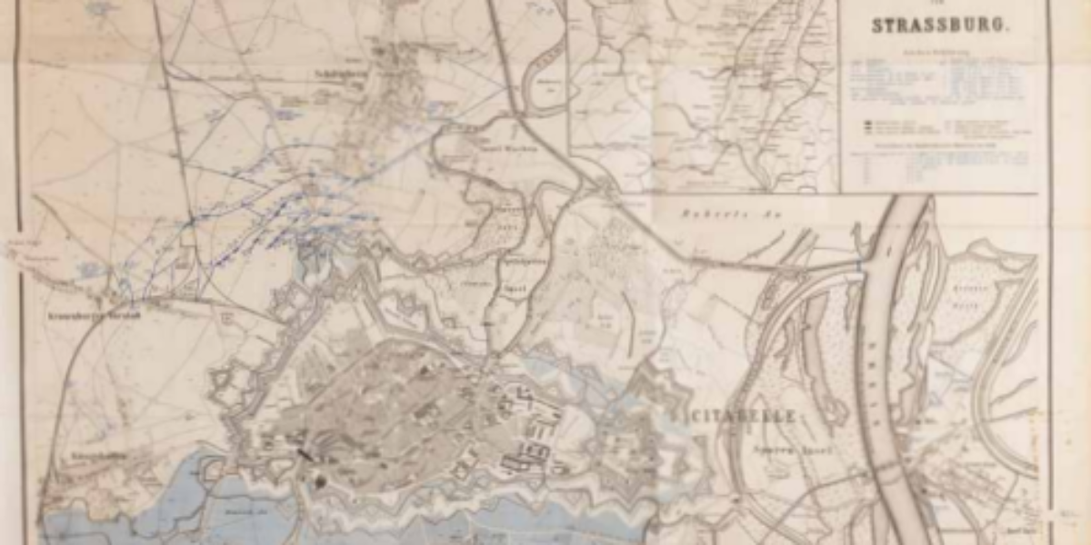
4. Belagerung von Strassburg
Water as an ineffective means of defence In the Franco-German War of 1870-1871, Strasbourg, one of France’s most modern fortresses, was besieged by troops from Baden and Württemberg. The extensive damage was attributed to the artillery shelling employed during the siege. This highlighted the vulnerability of traditional, static fortifications in the face of a highly…
5. Wegweiser
The Rhine as a modern transportation route This atlas served as a navigational tool for ships in a time predating the advent of radar and GPS technology. Over the course of a century, the Rhine River underwent modifications to accommodate modern navigation requirements. It wasn’t until the salt discharges from Alsace, which continued until 1998,…
6. The Duitschen Rijn
The power of the swelling Rhine During periods of high water levels in the Rhine, the river valley experiences inundation. This flooding highlights the size of the valley, despite the protective dikes built along it for centuries. The changing climate and the loss of upstream catchment basins cause larger volumes of water to occasionally flow…
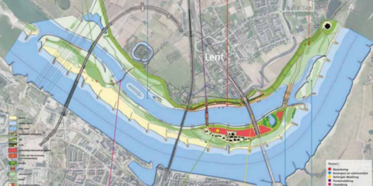
7. Room for the Waal
Room for the river, everyone wins In 1995, 250,000 people had to be evacuated from the Betuwe region due to the precarious state of the dikes. This event led to a shift in approach: The “Room for the River” initiative is a billion-dollar investment program with the aim of creating additional space for the Rhine…
8. Dijken der polderdistricten
Normalisation and regulation of the Rhine From 1765, the Rhineland surveyor and cartographer Melchior Bolstra initiated a systematic mapping of the Rhine. The river is measured in a standardised way and the symbolism on maps is normalised. This standardisation made far-reaching plans for regulation possible. The river is measured using standardised techniques, and the map…
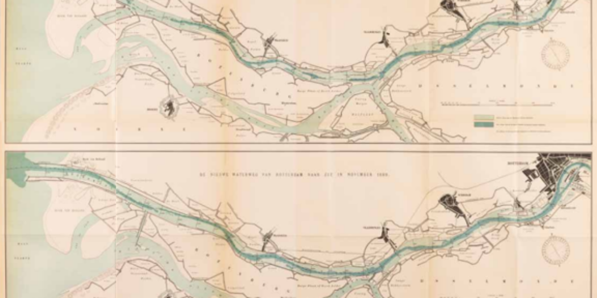
9. The New Waterway
Rotterdam’s new oesophagus In the 19th century, the port of Rotterdam faced an increasing problem regarding accessibility as ships increased in size. Engineer Pieter Caland develops an audacious plan: create the shortest possible connection through the Hook of Holland and construct a dam at the confluence of the Old and New Maas rivers. The natural…
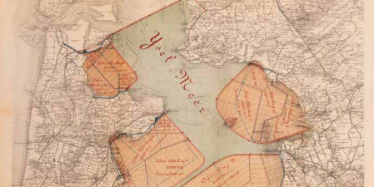
10. Afsluiting Zuiderzee
Shortening the coastline where technically possible Numerous dyke plans developed by the Zuiderzee Vereeniging preceded this design by Cornelis Lely et al. After this plan many more appeared before construction started. Lely was not only an inspired engineer, he was also a shrewd politician. During World War I, he was Minister of Water Management, and…
11. Leidingwater
Endangered drinking water as a public good The Netherlands currently has ten public drinking water companies serving the entire country. In 1940 those companies numbered in the hundreds. In many municipalities there were only private wells, while the various sources of drinking water in a previous era were striking: Dune water, surface water around Rotterdam,…
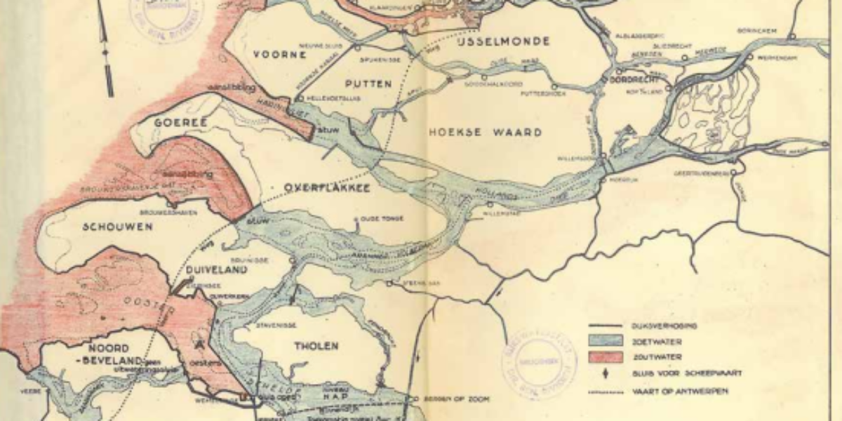
12. Directe Plan
Ominous advice regarding closing off Zeeland Two days before disaster strikes, engineer Johan van Veen presents his superiors with an ambitious plan to partially dam the sea arms in the south-west of the Netherlands. A rough sketch, certainly not a technical design, but the idea is clear. The goal is in line with Lely’s plans…
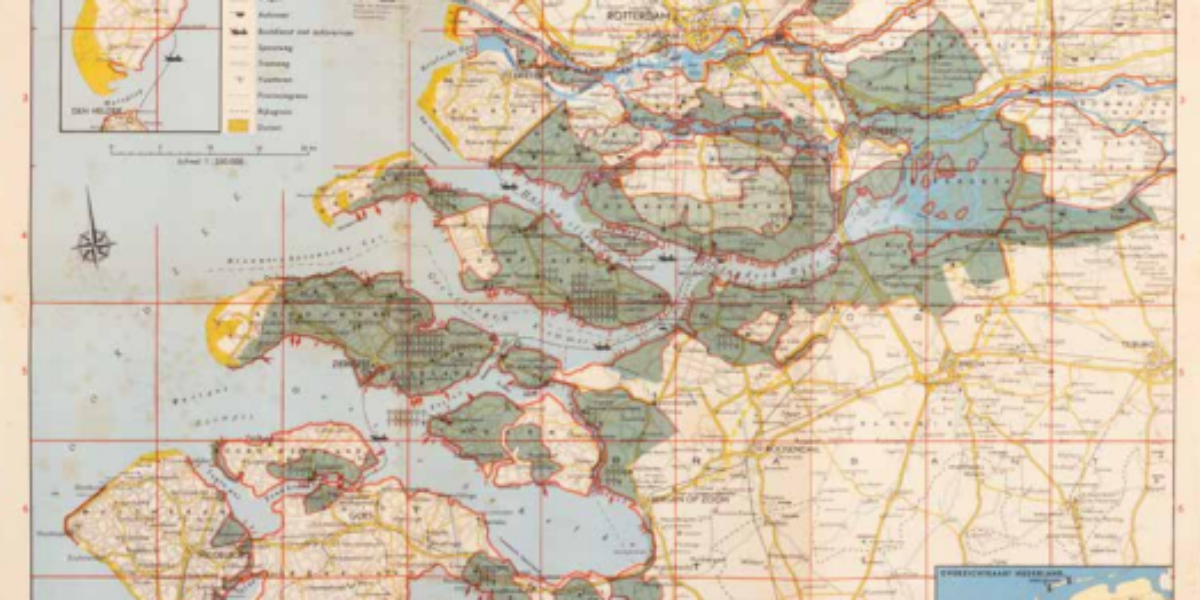
13. The Storm Surge
Disaster engulfs southwestern Netherlands Immediately after the flood disaster, a multitude of publications were initiated, among them this survey map depicting the flooded region. The purpose was to raise funds for the victims of the disaster. The map’s visual impact is intensified by the numerous crosses and arrows, adding to its dramatic effect. The Disaster…
14. Bedwongen Waterland
Shaky illusion of social engineering As the Delta Works gains momentum, the field of water management glows with confidence. This school record illustrates that a significant portion of the Netherlands is situated below sea level or at risk from river water, emphasising that the country’s water situation is “under control.”
15. Base Map Draft
Netherlands: terminus of river systems A fresh view on our nation is essential: viewing the Netherlands as the terminus of river systems. This explains the unconventional orientation of this map, where east is depicted at the top. This represented a new understanding of the Netherlands not as an isolated entity but one greatly affected by…
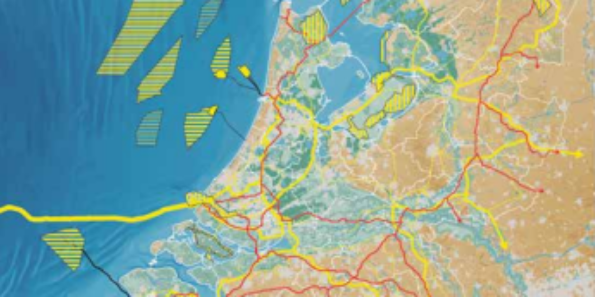
16. National Infrastructure
The sea, a colony for our energy? The national government plays an important role when it comes to energy, especially in times of climate change and geopolitical tensions in Europe. The National Environmental Vision takes a leading role in managing this situation. The transition to renewable energy sources is progressing rapidly: by 2023, a large…
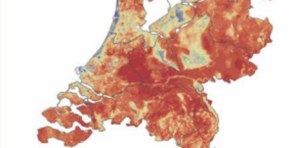
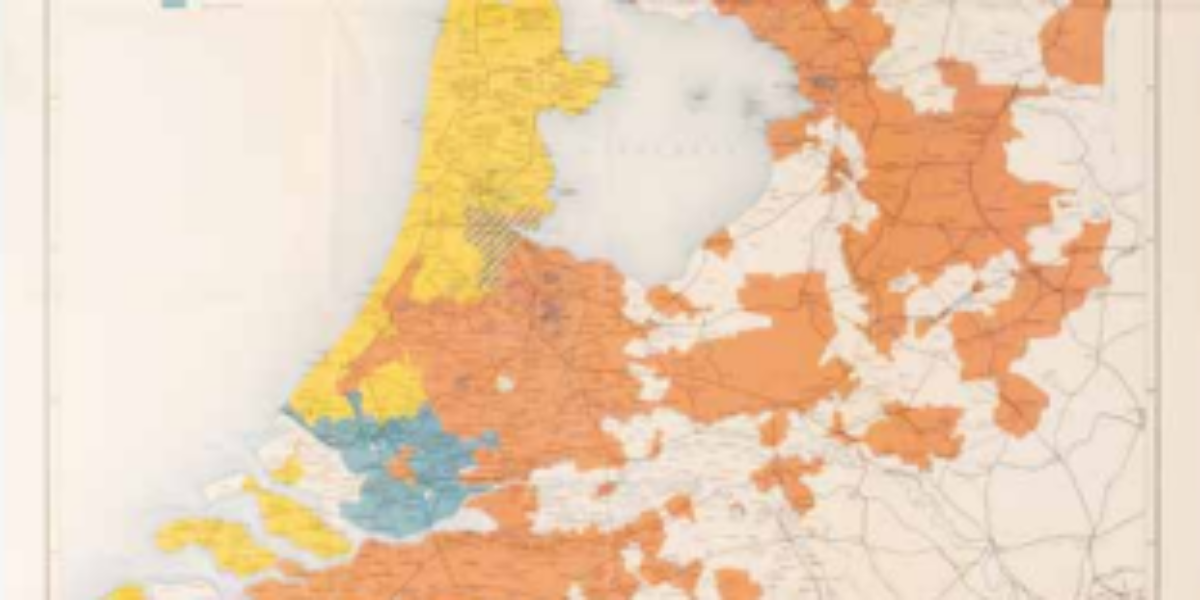
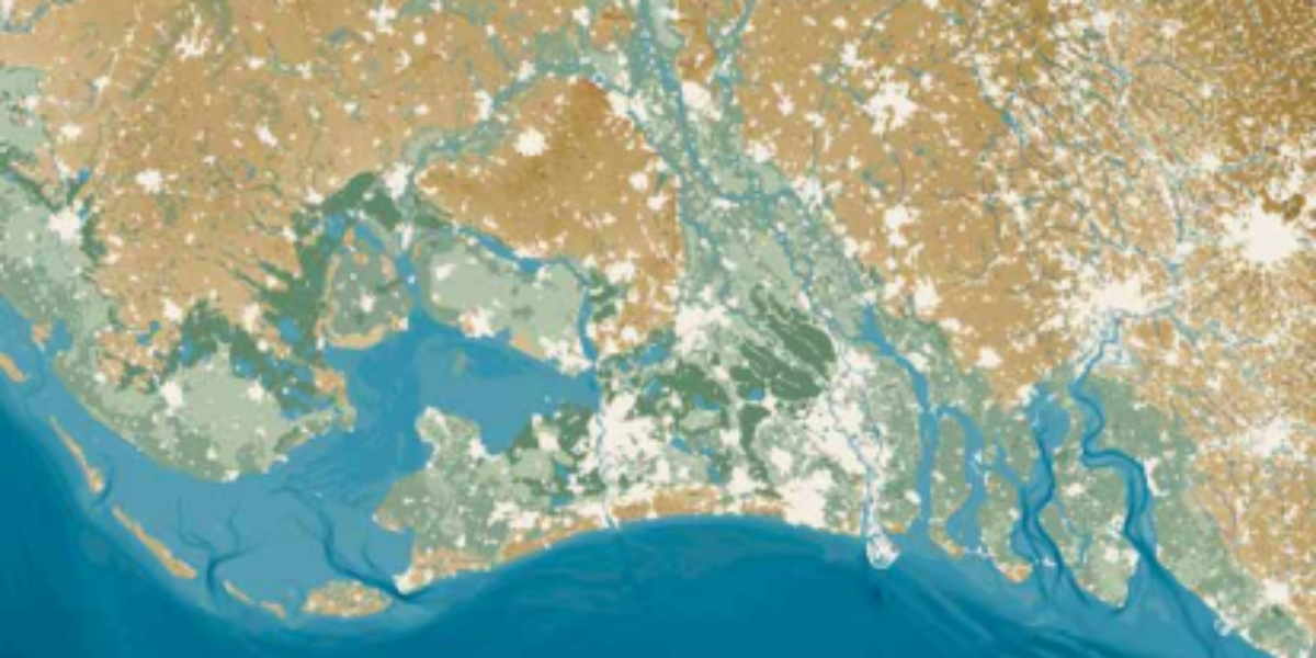
17. Soil Drought
Water scarcity as a new problem In the near future, climate change is amplifying the intensity of extreme weather events. Despite a 10 to 15% increase in precipitation since the 1960s, we are experiencing drier springs and summers. This shift has consequences, illustrated by this interactive map: by the end of September 2020, large regions…
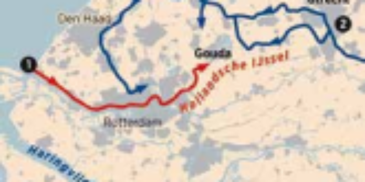
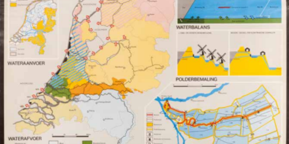
18a,b. Freshwater supply
We do not accept drought and salinization During long dry periods, the western part of the Netherlands increasingly experiences problems. As a result of the deepening of the Nieuwe Waterweg – Nieuwe Maas river, saltwater penetrates to the inlet pumping station near Gouda during low Rhine discharge. In increasingly hot summers, the water evaporates faster…
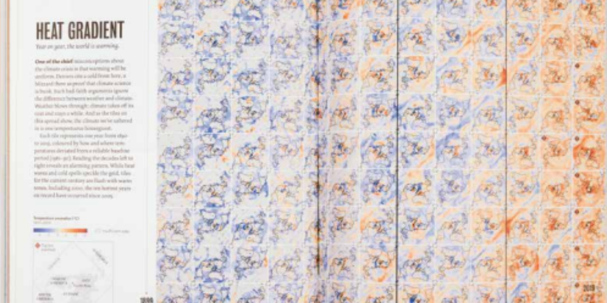
19. Heat Gradient
Weather is unpredictable, but climate typically appears more stable. Climate change historically involves slow shifts, from ice ages to warmer eras. The extensive use of fossil fuels has disrupted this natural progression. Since the industrial revolution, the climate’s behavior has shifted from occasional local heatwaves to a global trend of warming. The text on the…
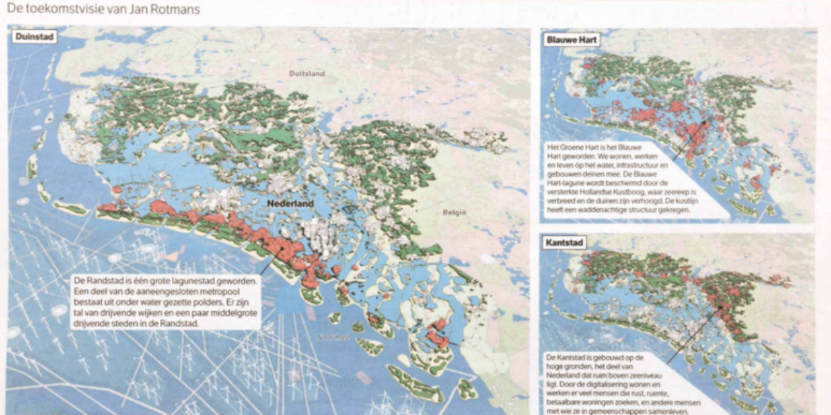
20. Blauwe Hart
Moving in sync with nature: it can be done, it must be done Visionary talk annoys property developers, real estate moguls and investors. This map is a rough indication of what the Netherlands might look like a century from now. Jan Rotmans, Professor of Transition Science, is neither a hydraulic engineer nor a climate expert….