The world of IT&T
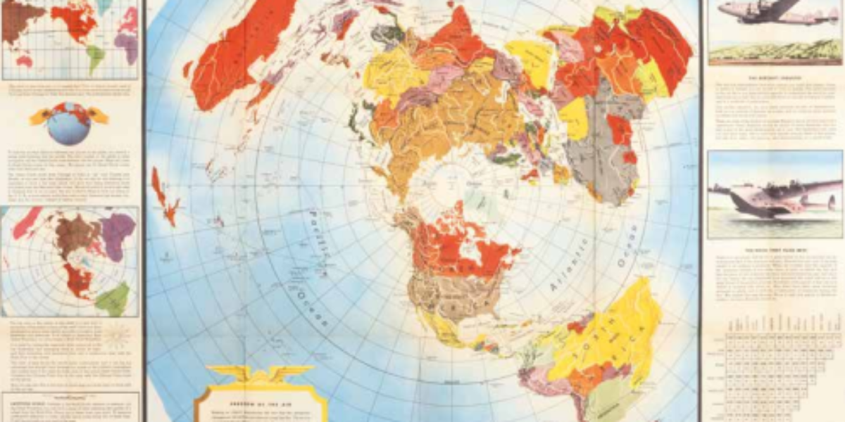
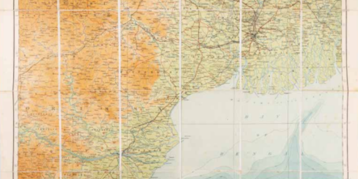
Scientific illustrator Edes Harrison plays a key role in developing cartographic perspectives that radically change everyday spatial concepts while America emerges as a superpower. This distance-focused twopoint map projection presents the entire world from two centres, places at the same distance from the centres always lie on one circle. Here, the chosen centres represent the two headquarters of the ‘International Telephone and Telegraph Corporation’: New York and in San Francisco. I.T.&T. covers the entire communications chain, from researchers, managers and technicians to automatic switchboards, cables, and antennas. This US telecoms company, with operations across two oceans and six continents, has a tumultuous history, also on the stock market. In fact, through a subsidiary in Berlin, it had a significant stake in aircraft construction for the Luftwaffe until December 1941.
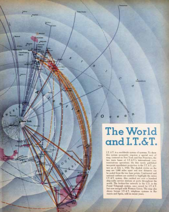
R. Edes Harrison, The World and I.T.&T., in: Fortune Vol. XXXII, New York 1945. Coll. S/T W.9e.64, 33.5 x 54 cm.
More chapters
1a,b. Historical Atlas
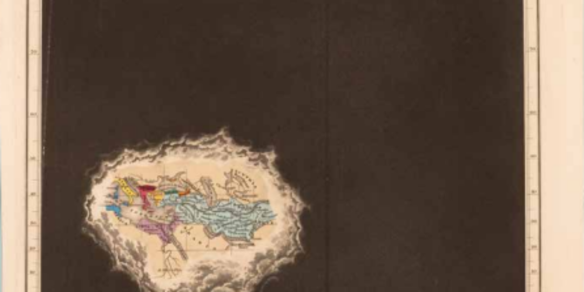
Clouds of western ignorance With 21 maps, Edward Quin’s atlas presents all political changes from creation in 2348 BC. At crucial moments of history, from a celestial perspective, worlds known at the time light up amid dark clouds. By passing the eye quickly over the engravings, with the same territory in the same place, the…
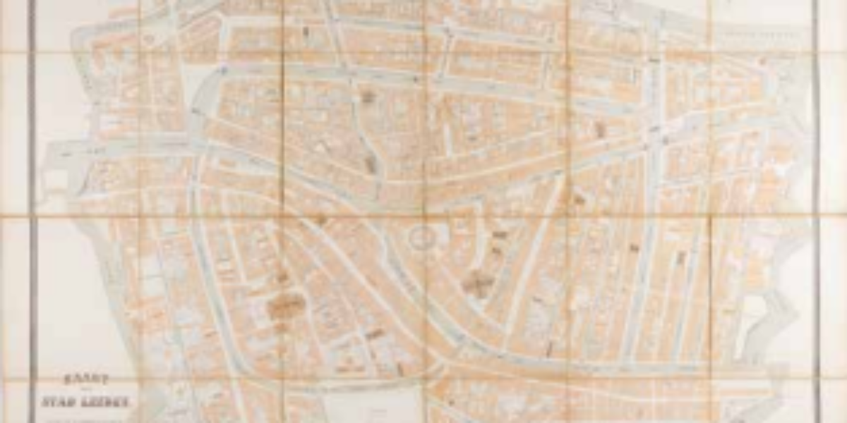
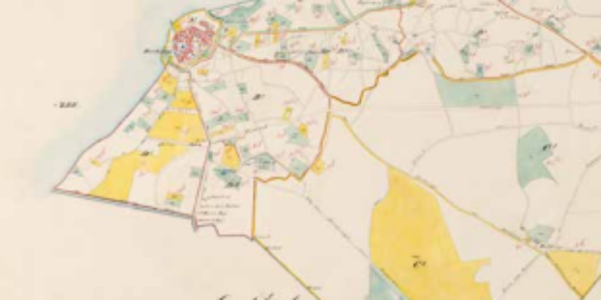
2. Overijssel Province
First modern map of Overijssel In the nineteenth century, unmeasured and undescribed places not only disappear from our world maps, but the interior is also increasingly mapped. Based on triangulation of our country by Kraijenhoff and systematic mapping by the Cadastral Registry, accurate provincial maps were made at the insistence of the Minister of the…
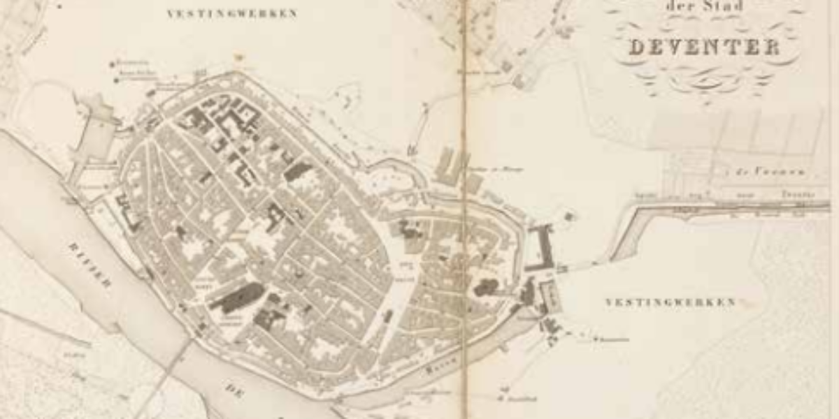
3. City of Leiden
Earthly precision and celestial reference Due to the large scale here, all plots can be drawn separately and no separate legend is needed. Buildings are always shown in orange according to their exact ground plan, except for the churches and the synagogue (Israelit. Kerk), where the roof structures are coloured brown. But in this reference…
4. Municipality of Harderwijk
Harderwijk cadastral map Since 1832, the Land Registry has been registering land ownership: every plot of land is measured and mapped. Owners are hereby registered so that the government can levy taxes on land ownership and property disputes can be settled.
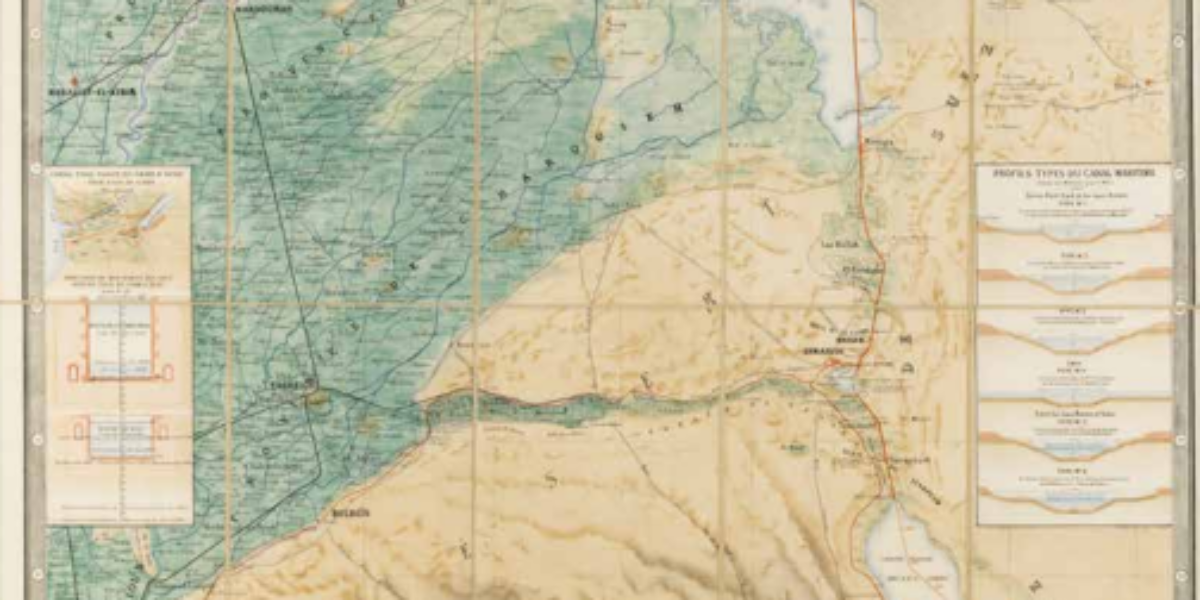
5. Carte de l’Isthme
Official map of the Suez Canal This rare chromolithographic map of a waterway without locks (the thick red line) through the isthmus between Port Saïd and Suez appears three years before the grand opening of the Suez Canal. A publication of the responsible joint-stock company,it is intended to promote the modern mega-project and is to…
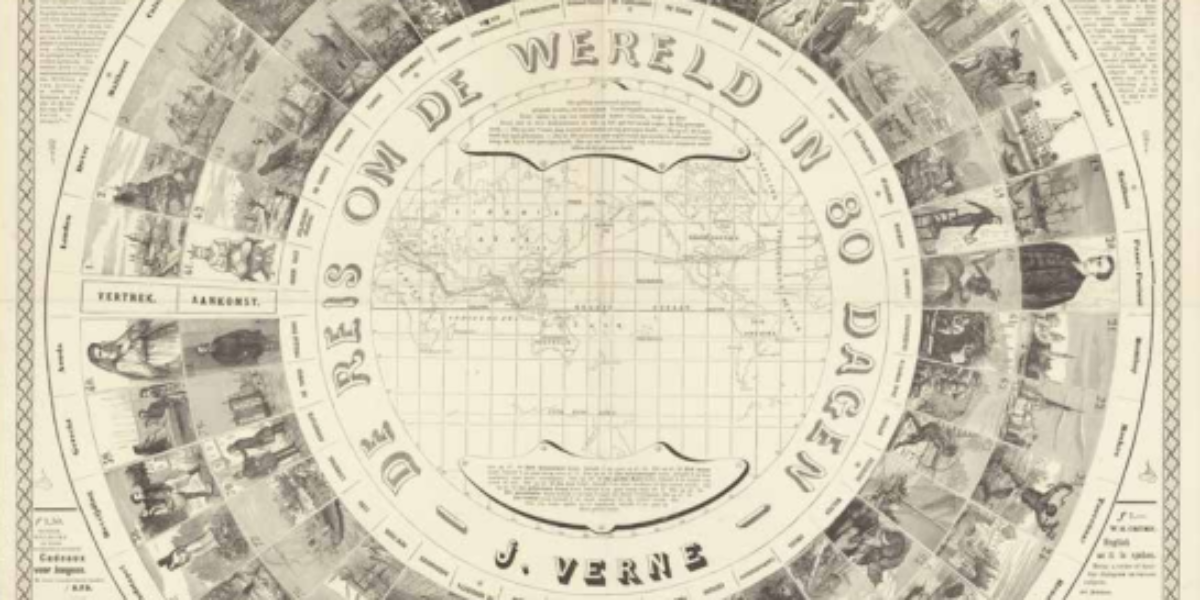
6. Journey around the World
Journey around the world in eighty days The time-honoured Game of the Goose is adapted here from Jules Verne’s popular novel Journey around the world in 80 days. For a wager at his London Reform Club, gentleman Phileas Fogg (10) travels eastwards around the world (see map) with his French servant Passepartout (20), overcoming various…
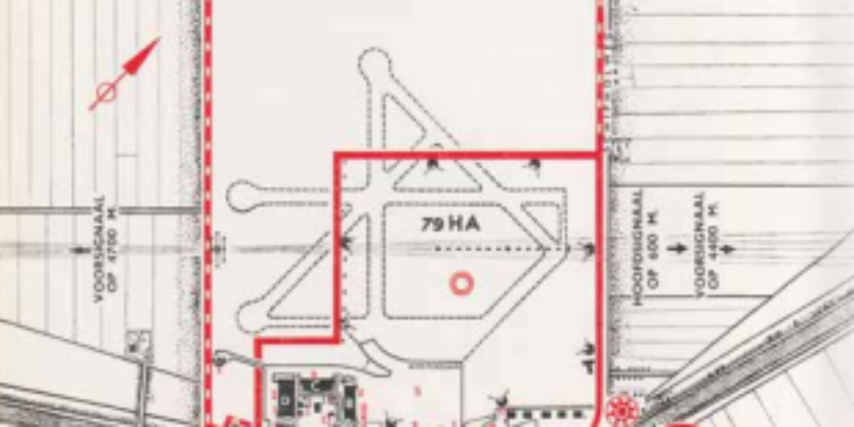
7. Airport Amsterdam
Schiphol day and night This map shows the expansion of the airport in 1935: from 79 to 210 hectares (compared to 2787 hectares in 2023!). There is also a night landing facility set up and four asphalt concrete runways, instead of grass. This results in continuous flights also in the evening and at night and,…
8a,b. Global Peace
Shrinking the world This world map was designed by magazine illustrator Antonio Petrucelli in 1943 and published by US company Alcoa Aluminium. The North Pole is at the centre. Of interest to the company is the logistical advantage of the shorter route between Chicago and Tokyo, which this North Pole projection compares with the longer…
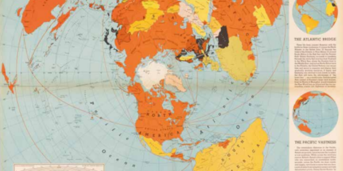
9a,b. One World
One world, one war Edes Harrison argues with this map that the proximity of the northern continents makes the United States the strategic hub for trade and security. The ‘Air Map’ exudes that modern air travel enables direct air connections, and borders between oceans, continents and countries are no longer relevant. Visually, this is reinforced…
10. Sectional Aeronautical Chart
Flying by sight and radio beacons ‘Sectional Aeronautical Charts’ are indispensable for pilots navigating primarily by sight; the 1:500,000 scale is intended for civil aviation at speeds up to 600 km/h. In addition to colours and contour lines for relief, the chart presents visual landmarks for navigation under visual flight rules. Striking are the purple-brown…
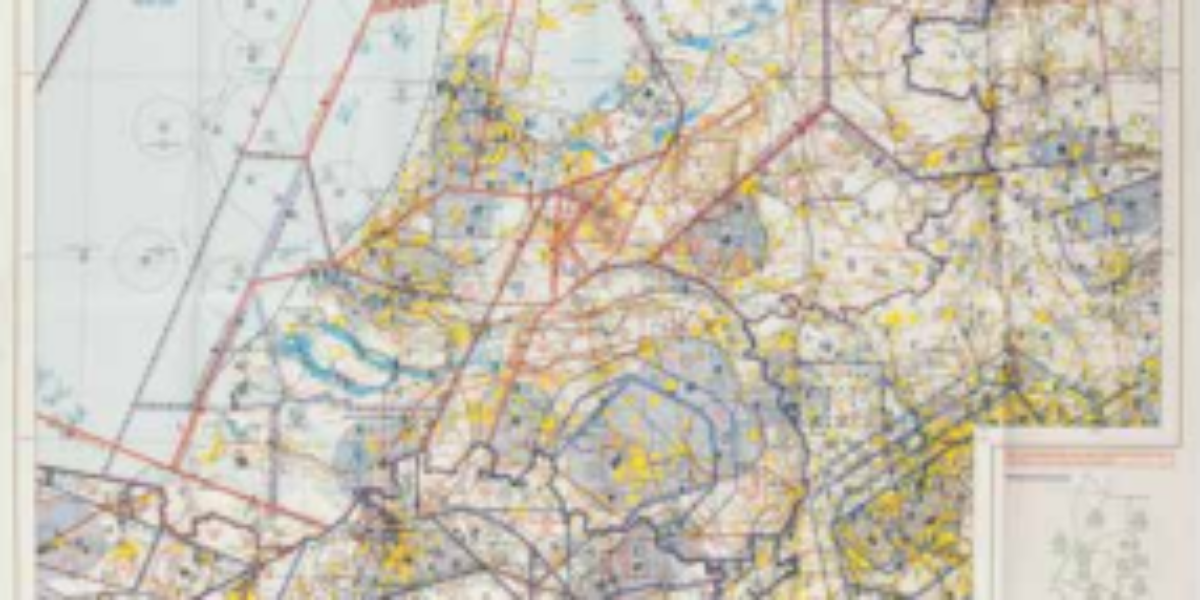
11. Aeronautical Chart
Aeronautical map of the Netherlands With these 1:500,000-scale maps combined with electronic means navigation equipment, pilots can determine all relevant things: their position, safe altitude, the best route to a destination, alternative landing areas, radio frequencies and airspace boundaries.
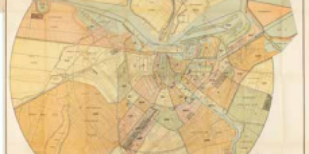
12. Municipal telephone
Amsterdam municipal telephone This circular map of Amsterdam with the Westertoren as its centre shows for each neighbourhood where the telephone lines continue above ground: the take-off points. Although most connections are still within the ring of canals, the network has spread further into several districts.
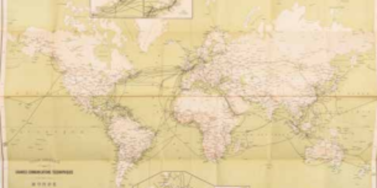
13. Carte Générale
World network telegraph communications This map presents the international network of existing and projected telegraph cables. The network of radio telegraph links plays a decisive role in the globalisation process before World War I.
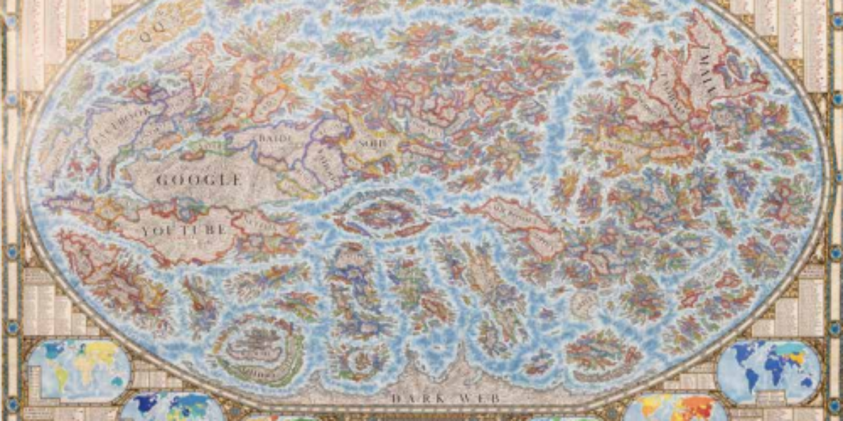
15. The Internet
Baroque internet map This internet map visualises the worldwide web and documents the most popular websites of 2021-22. Thousands of websites are presented as ‘countries’ and grouped with similar websites into ‘regions and continents’. Their features, services and creators are labelled as ‘cities’. The stronger their mutual links, the closer the websites are to each…
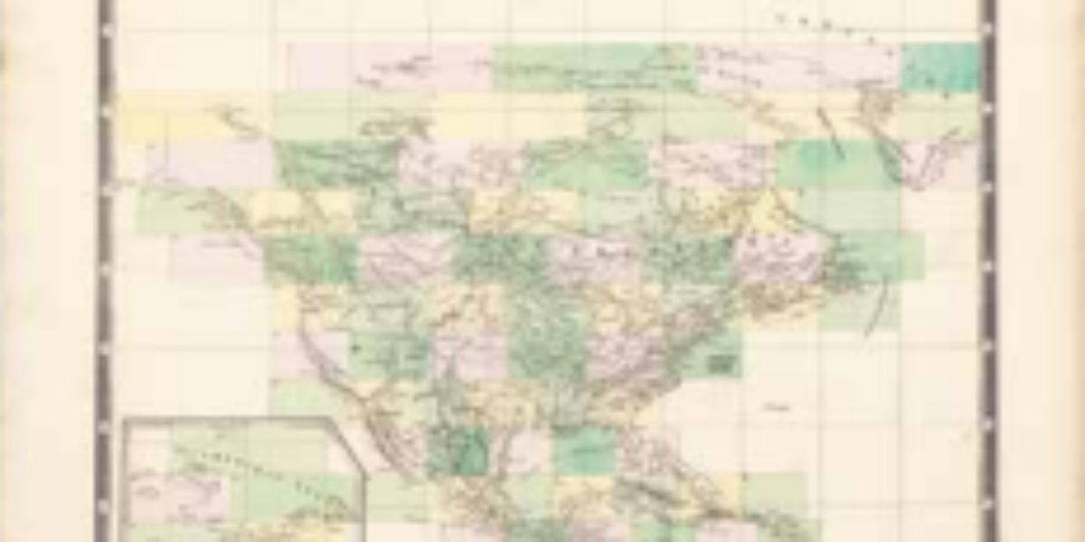
16a,b. Atlas universel
Universal atlas The encyclopaedic geographer and self-taught cartographer Philippe Vandermaelen is the creator of the Atlas Universel, the first world atlas with 400 maps on the same scale. Here you can see the overview sheet for the 76 sheets of North America. He then publishes an Atlas de l’Europe on 165 sheets, with a scale…
17. Calcutta
International maps of the world In 1891, the ‘International Map of the World’ project was launched to provide ‘a politically neutral representation of geographical facts’. Only decades later an agreement was reached on the Greenwich prime meridian, while the metric system was used for scale. When this utopian project was finally completed in 1986, its…
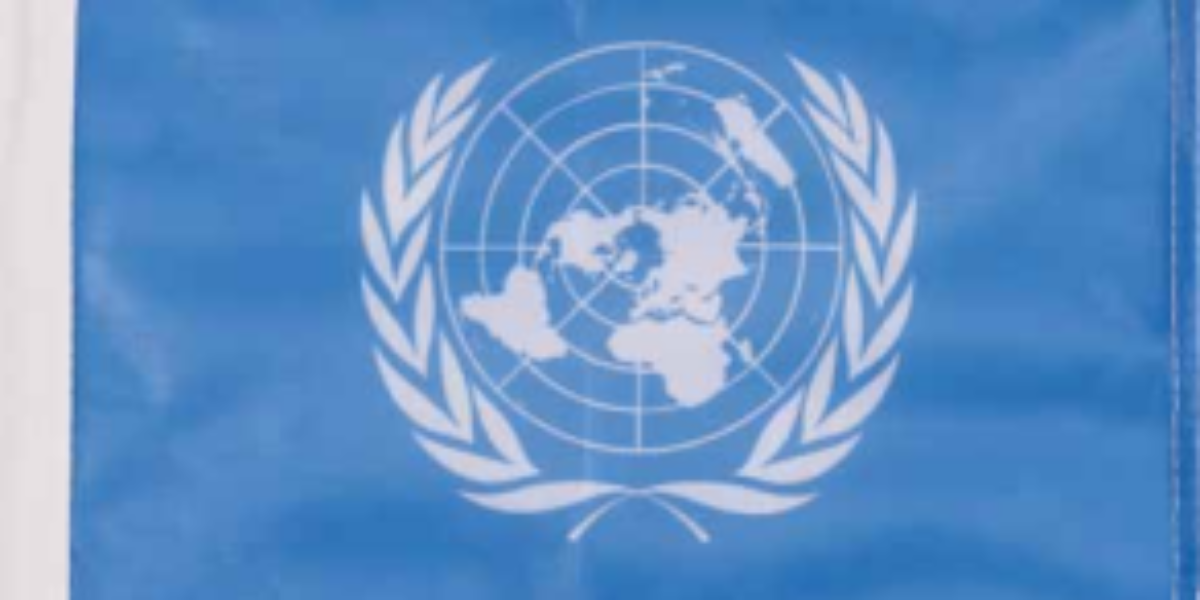
18. Flag United Nations
Quarter turn for the United Nations This boat flag with the United Nations emblem presents a world map centred on the North Pole, surrounded by two olive branches symbolising world peace. This is the second version from 1946, rotated a quarter turn clockwise to avoid the appearance of favouring the United States.
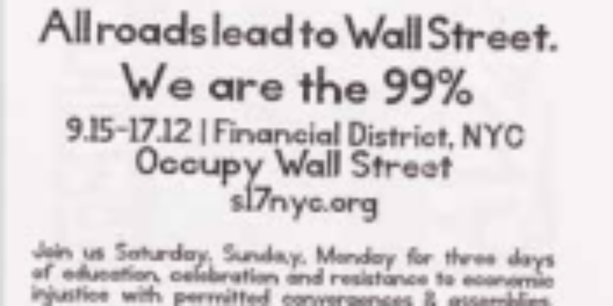
19a,b. Wall Street
Occupy Wall Street When the credit crunch causes house prices to plummet and forces millions of people default on their mortgages, Wall Street threatens to crash in the autumn of 2008. To prevent another – by now global -economic crisis, Bush and Obama organise a huge investment bank bailout. However, shifting the cost of the…
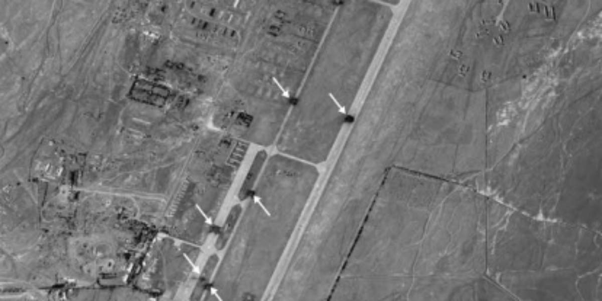
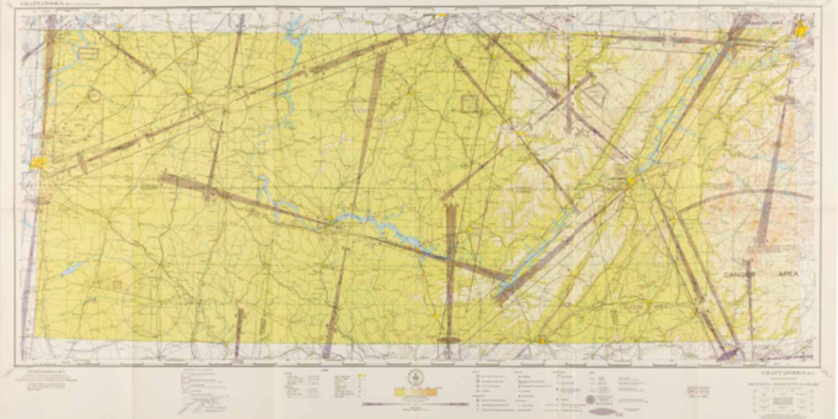
20. Shindand Airfield
Glocalisation of cruise weapons October 2001, US, British and allied forces, together with the Afghan Northern Alliance, launch their offensive against the Taliban, Bin Laden’s supposed protectors. In the process, the concrete airstrip of Shindand airbase is also hit by cruise missiles (see arrows in this aerial photo). This attack is not based on large-scale…
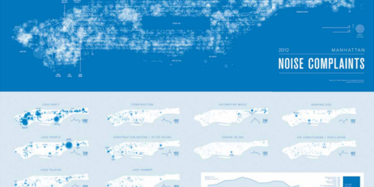
21. Noise Complaints
Noise pollution Manhattan Monochrome maps here locate and classify 40,412 noise complaints in Manhattan in 2012, which came in through the city’s complaint line. This thematic map by Brooklyn-based designer Karl Sluis is not based on a simplified topographic map like Google Maps. His visualisation of mass data creates an overview map of the “noisiest…
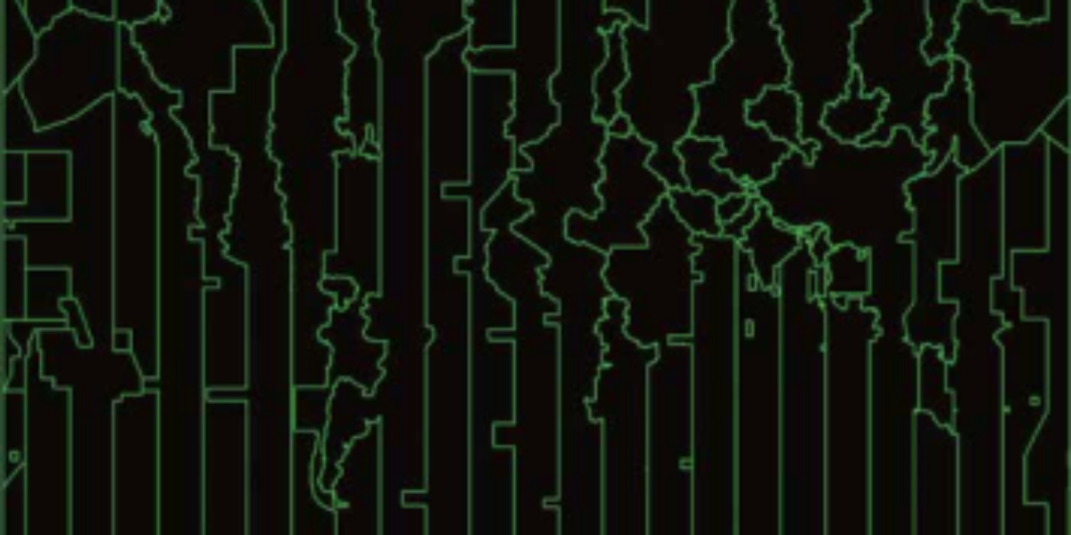
22. Time Zones
Just time zones This fascinating digital map from the ‘Cartographers without Borders’ website delineates global time zones. Since 1972, the modern time standard (UCT) has been based on an atomic clock attuned to the earth’s rotation. The UTC is the successor to the Greenwich Mean Time (GMT) and differs from this by no more than…