Soviet Union tablecloth
This plasticised map of the Union of Soviet Socialist Republics (USSR), with its division into formal republics and constituent republics, portrays the vast Russian empire in a dominant red colour. At the time of the USSR’s establishment, each republic was granted the right of secession (which would later be exercised by all former Soviet republics in 1991). However, during the period this map represents, the USSR functions as an ultra-centralised empire under the control of the Communist Party Central Committee.
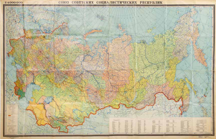
Main Directorate of Geodesy and Cartography under the Council of Ministers of the USSR, Soyuz Sovietskich Sotsialistitsjeskich Respoeblik (Union of Soviet Socialist Republics), Moskwa 1983. Coll. S/T W.2v.29, 144 x 221 cm.
More chapters
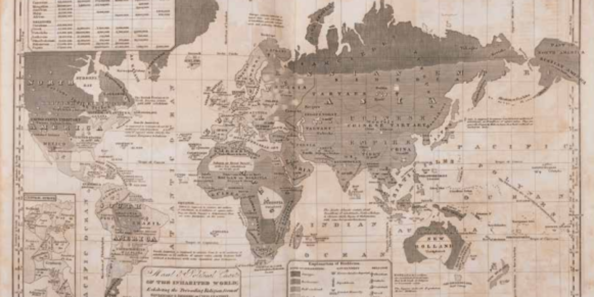
1. Moral and Political Chart
From savages to enlighten This moral and political map is often reprinted from 1821 onwards, including in the School Atlas by Woodbridge and unnamed co-author Emma Willard. Geographically for schoolchildren and the general public, the atlas depicts Western superiority through a modern approach to the process of civilisation. The development from savages, through barbarians, semi-civilised…
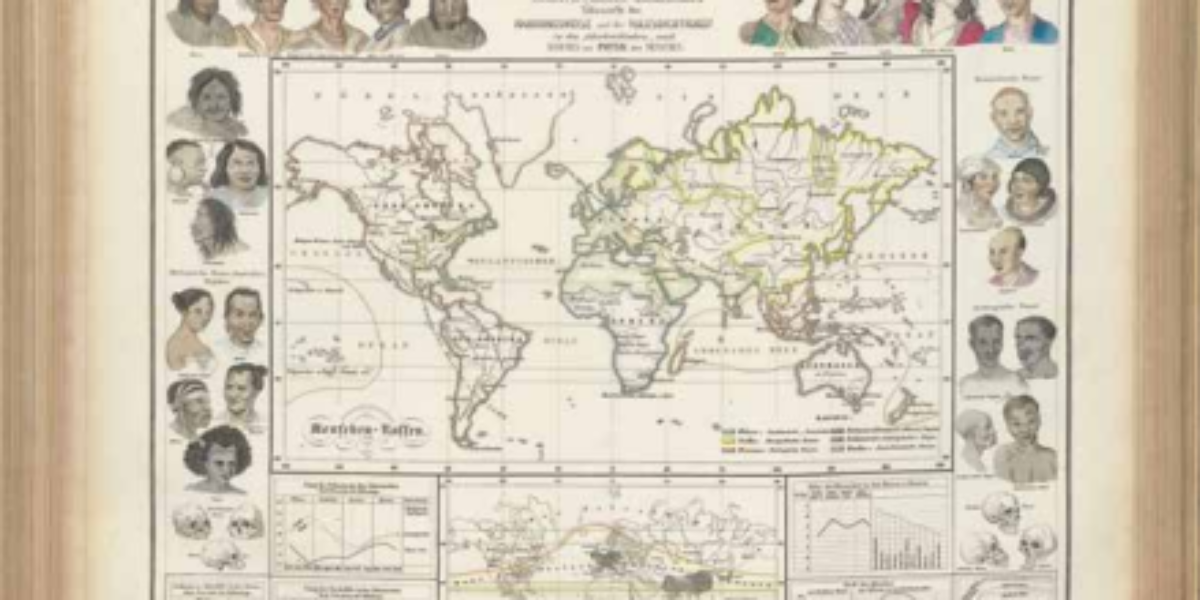
2. Menschen-Rassen
Distribution of human races Dr. Heinrich Berghaus played a pivotal role in advancing modern thematic cartography with his Physikalischer Atlas. The anthropographic atlas section includes a map that differentiates six distinct races. A wreath of representative heads showcases various skin colors, facial features, and skull shapes associated with these six racial groups. Unfortunately, racism also…
3. Mission Print Map
Mission postcard Mission cards, which reached their apex in the mid-19th century, play an important role in garnering financial support for the global dissemination of Christianity. During this period, missionary efforts were primarily focused on the colonies. However, it should be noted that some Christian missions also advocated for the liberation of Black individuals from…
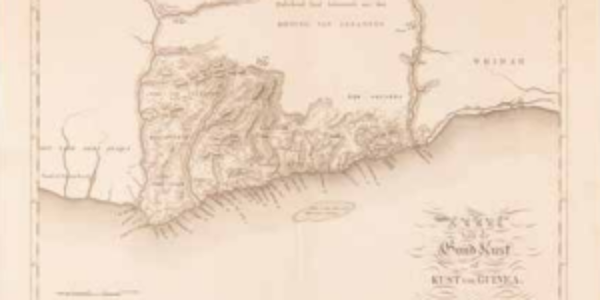
4. Coast of Guinea
Map of the Dutch Gold Coast Following the capture of the Guinean fort St. George Del Mina in 1637, the fort expanded to become the Dutch Gold Coast. Equipped with factories, this fortress became the focal point for the West India Company (WIC) and their slave trading via Curaçao. In 1871, the Netherlands sells this…
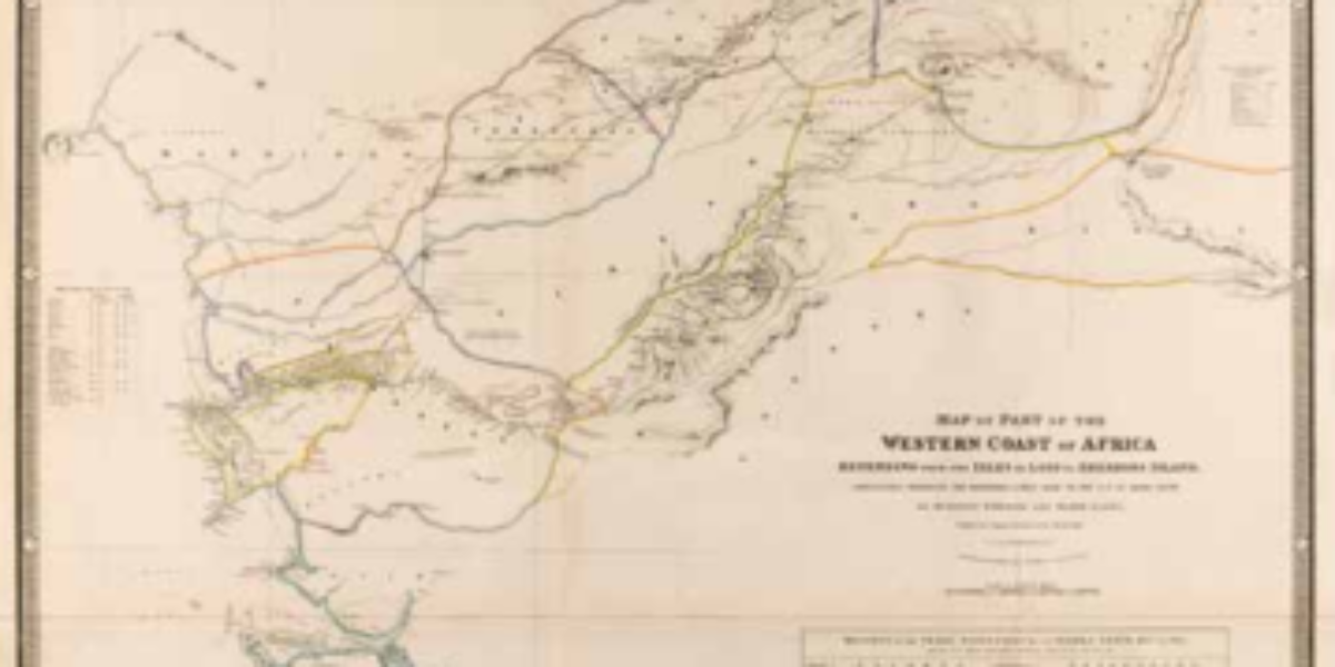
5. Western Coast of Africa
Return of enslaved people to West Africa This map of West Africa depicts in colours the routes of four expeditions conducted between 1794 and 1822, which aimed to explore the interior of Sierra Leone and a portion of Guinea. Two of the explorers were responsible for creating this map. Importantly, after the abolition of slavery,…
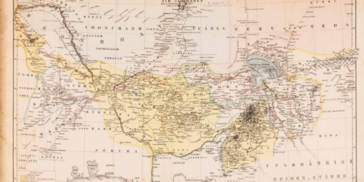
6. Karte von Central Afrika
Slavery in the Sokotokaliphate Heinrich Barth, a German Arabist, provides an account of his ‘voyage of discovery’ through Central and West Africa, which is traced by the red lines on the map. Barth’s argument revolves around the idea that the ethnic identity of the peoples he encounters is determined by their history. During his expedition,…
7a,b. The Colonization of Africa
Slave trade and colonisation Harry Johnston, an explorer and colonial administrator, was fluent in several African languages and wielded significant influence over British colonial policy. In the ‘British Central African Protectorate,’ he led battles against Muslim Swahili and Yao slave traders. His first map delineates the slave traders’ ‘hunting grounds,’ distinguishing them through light and…
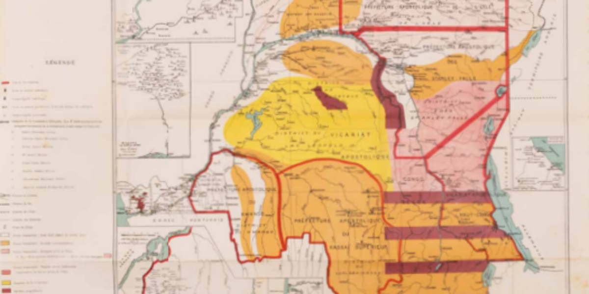
8. Bulletin de la Societé
Leopold’s reign of terror in Congo In 1885, the Berlin Conference designated Congo Free State (an area 76 times the size of Belgium!) as the personal possession of King Leopold II. The map uses colours to divide the country into various concession areas. Private companies exploit raw materials here, especially rubber for the transport industry,…
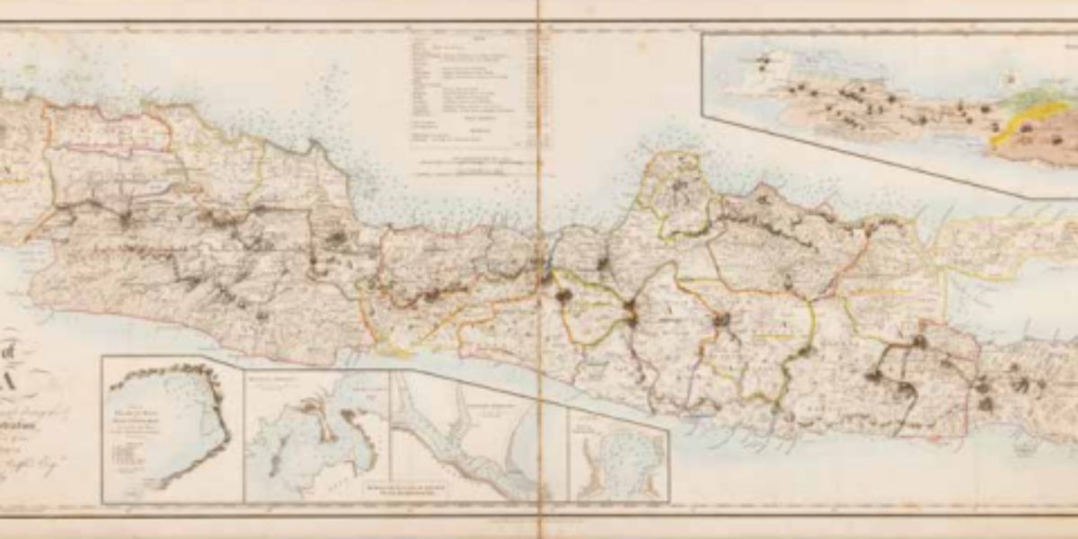
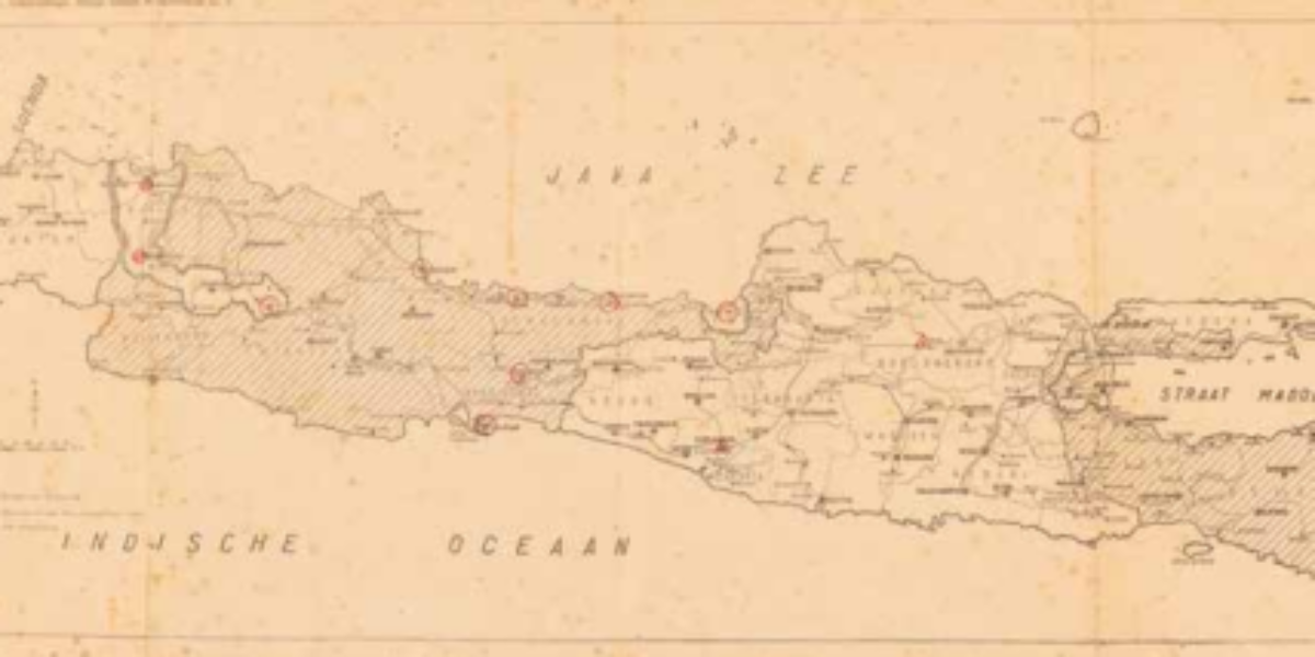
9. The History of Java
Map of British Java Following the French annexation of the Kingdom of Holland, Stamford Raffles leads a British military expedition against Java in 1811 and becomes lieutenant governor of the East Indies. During his tenure, cartographer J. Walker conducted land measurements and assigned geographical names, which form the basis for this fine topographical map of…
10. Occupied in Greater Aceh
Netherlands’ bloodiest colonial war Cartographer Thomson became an infantry first lieutenant in the Royal Dutch East Indies Army (KNIL) in 1894. At that time, the Dutch had been embroiled in their bloodiest colonial conflict in the Sultanate of Aceh for decades. During his tenure as a member of parliament in 1906, Thomson criticised what he…
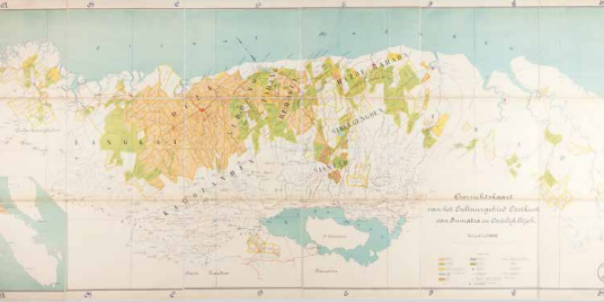
11. East Coast of Sumatra
Kulie plantations on Sumatra’s east coast After 1970, Western entrepreneurs managed to secure extensive agricultural concessions on Sumatra’s east coast after 1870, especially for tobacco and rubber plantations (indicated in orange and green). Over time, these plantations account for 20% of the Dutch East Indies’ exports. High dividends for Dutch shareholders in these coolie plantations…
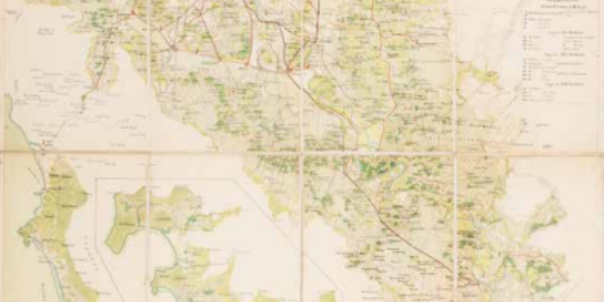
12. Map of Java
Prelude to ‘Police Action‘ Following Japan’s surrender, Sukarno proclaimed the Republik Indonesia on 17 August 1945. The Netherlands does not recognise the Republik and at most wants to introduce a federal form of state under the Crown. This March 1947 map is published during the prelude to the first ‘police action’ that culminates in numerous…
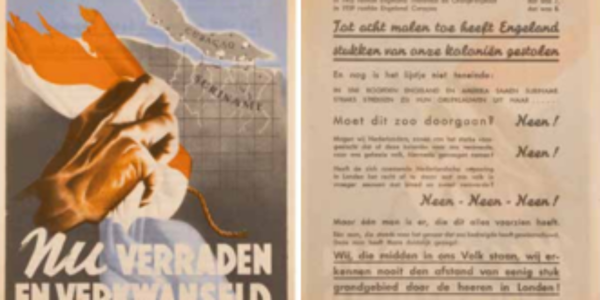
13. With blood and sweat
NSB pamphlet Suriname and Curaçao As represented in this pamphlet, the National Socialist Movement (NSB) takes issue with Britain and America foreign policies. It was prompted by the Dutch government-in-exile’s permission in November 1941 to station American troops in Suriname to protect the bauxite mines (a raw material essential for the production of aluminium). At…
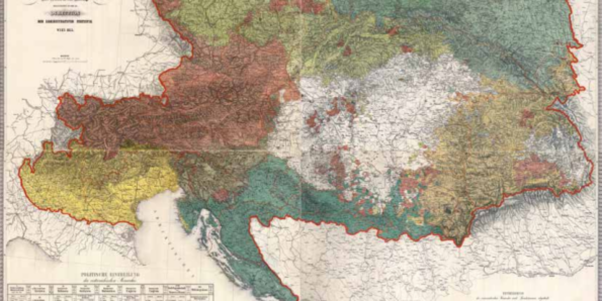
14. Oesterreichischen Monarchie
Ethnographic map Austrian monarchy Karl von Czoernig, the chief statistical officer of Austria, used this map to envision a restored Habsburg order after the national uprisings of 1848. The multiplicity of nationalities here does not yet rule out political unity, nor do the 14 language branches here cross imperial borders.
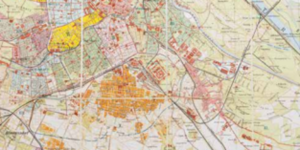
15. Reichshaupt- und Residenzstadt
Capital of ‘Kakania‘ Since 1867, Vienna has served as the capital of ‘Kakania,’ an ironic term referring to the ‘kaiserlich-königlichen Doppelmonarchie Österreich-Ungarn.’ The map illustrates the old city centre (I) and the desolate slums located beyond it (e.g., II and VII). Due to the rapidly increasing population, new neighbourhoods (XXI and X) are being constructed…
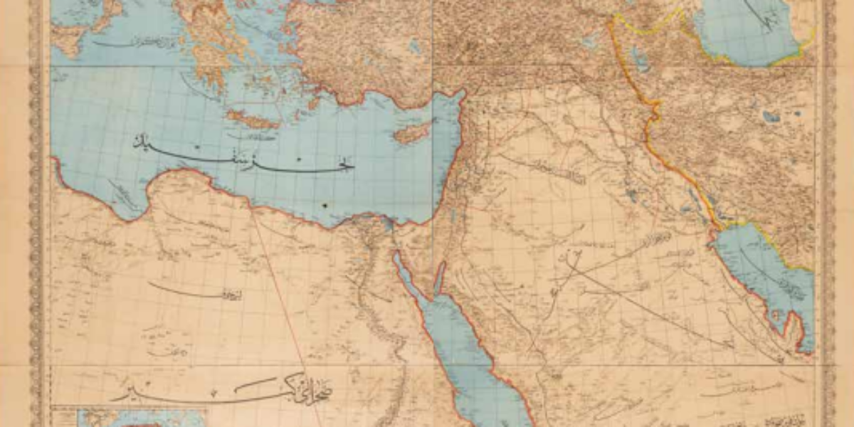
16.’Well-preserved Imperial Lands’
Map of the Greater Ottoman Empire This map of the Ottoman Empire depicts a vast empire spanning three continents, but there are some notable issues with its red outer borders: Bosnia-Herzegovina is still depicted as part of the Ottoman Empire, despite being occupied since 1878 and annexed by Austria-Hungary in 1908. Bulgaria is shown as…
17. Map of Istanbul
Istanbul and the Bosphorus This rare staff map is, as the colophon states in Ottoman-Turkish, from the Printing Office of the United Chiefs of Staff. Only late in the 19th century did the Ottoman army adopt map techniques from France and Germany, including the standard 1:50,000 scale (1cm on the map is 500m on the…
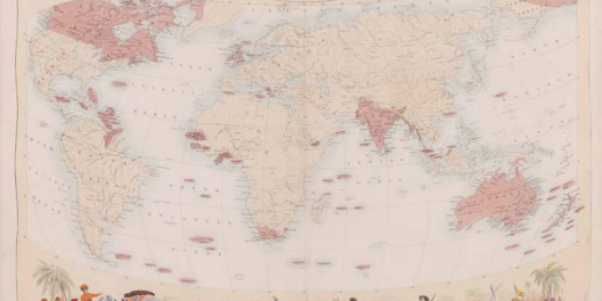
18a,b. British Empire
The British Empire under George V During the 19th century, the rose-red British Empire was characterised by its pursuit of raw materials for industry and the creation of markets for its manufactured goods. Congruently, it also required the establishment of strategic naval bases and supply stations around the world. This map reflects the belief in…
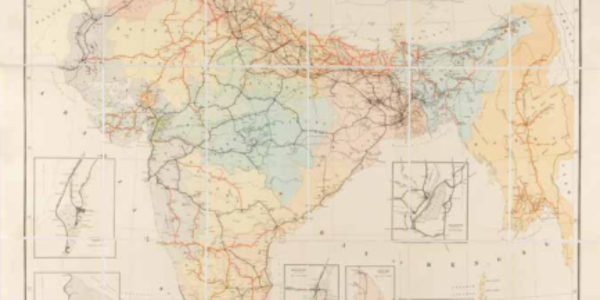
19. Indian railways
Railways in the British East Indies British India (1858-1947) comprises the present-day countries of India, Pakistan, Bangladesh, Sri Lanka and Myanmar, and is considered the ‘crown jewel’ of the British empire. The Indian railway system plays a pivotal role in the development of infrastructure, including the construction of dams, aqueducts, bridges, and the transport of…
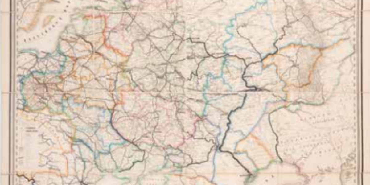
20. European Russia and Siberia
European Russia and Siberia This hand-painted ‘map of European Russia and Siberia’ with inset map ‘Asian Russia’ depicts the administrative division of the tsarist empire into various governorates and their respective provinces. This modern map provides detailed information on areas, population figures, and distances. The Russian Empire was characterised by its multilingual and multi-religious composition;…
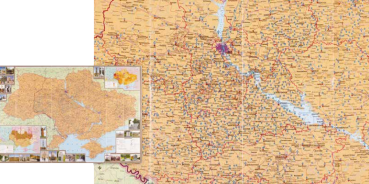
21. Ukraine Holodomor
Four million starvation deaths in Ukraine On the largest map, innumerable blue markers indicate the memorials and monuments erected to commemorate the victims of Holodomor, the devastating genocide by starvation that occurred in 1932-’33. Over five million people perished, four million in Ukraine alone. The yellow crosses refer to the few pre-1990 memorial plaques.
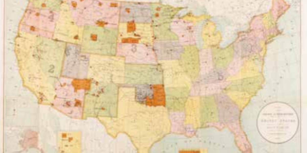
23. Indian Reservations
‘Kill the Indian, save the man‘ This map illustrates the remaining tribal areas of Native Americans following a devastating history of epidemics, conflicts, and ethnic cleansing during the era of westward expansion in the United States. Aside from the remaining reservations, the map also highlights the 22 boarding schools for Native American children, denoted by…
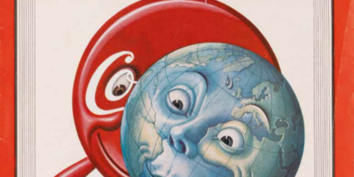
24. Coca-cola
Coca-Cola conquers the world Boris Artzybasheff is known for his surreal illustrations in popular American magazines. This drawing on the cover of Time Magazine, showing Coca-Cola giving a happy baby globe its bottle, accompanies an article about the marketing strategy this ‘company’ uses to conquer the world. Coke bottlers travelled with the US armies during…
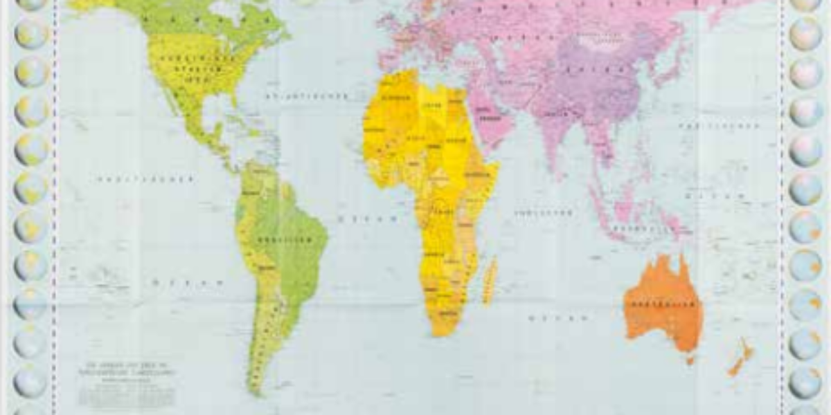
25. Flächentreuer Projektion
Controversial Peters projection On the traditional Mercator-projected world map, Europe appears much larger than South America, even though in reality it covers only a third of its area. Additionally, the map by the 16th-century geographer Mercator gives more emphasis to the northern hemisphere. East German cartographer Peters challenged this Eurocentric view by introducing a new…
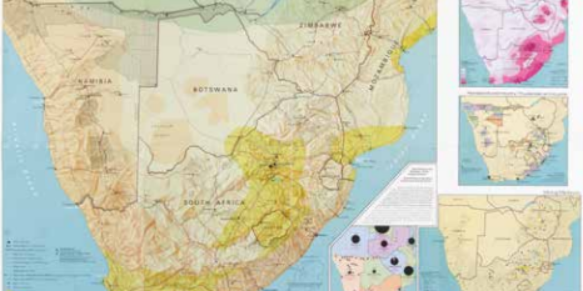
26. Repression and resistance
Oppression and resistance in South Africa This map is part of the Komitee Southern Africa’s (KZA) educational folder titled ‘This is Apartheid.’ Apartheid was a system that enforced racial segregation, separating people into categories such as Bantus, Coloureds, Asians, and Whites. Black people residing in ‘white areas’ – even if their families had lived there…
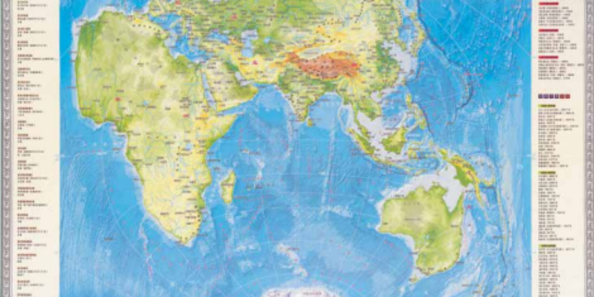
27. Shi jie di shi tu
Bipolar Chinese world map This vertical world map puts Europe as an appendage of Asia. North America is upside down and cut off from South America, and Africa is eccentric. Here, the ‘Middle Kingdom’ and the Indian Ocean take centre stage. Indeed, around this is the focus of the ‘Belt and Road Initiative’, the largest…
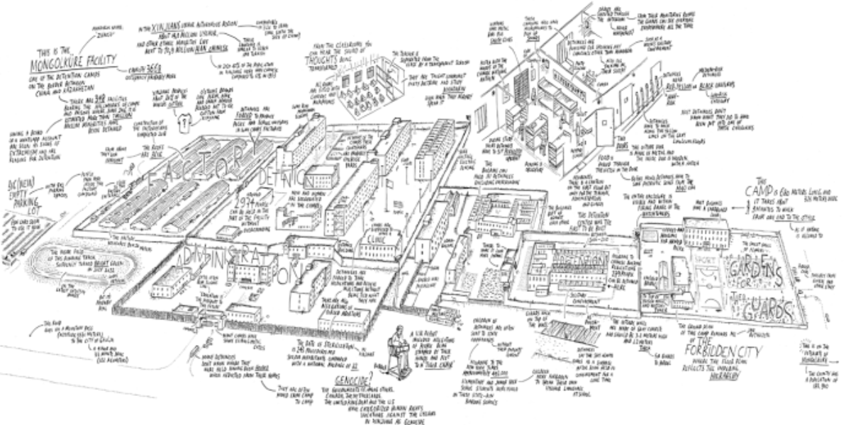
28. Mongolkure Camp
Chinese re-education and punishment camp On the road to Ghulja, a city in China’s Xinjiang autonomous region close to the border with Kazakhstan, lies one of 381 (!) internment camps where mostly Uyghur Muslims are ‘re-educated’. The map shows Camp Mongolkure as the crow flies and was made for the installation ‘Investigating Xinjiang’s Network of…