The Dutch ‘officer’s briefcase‘
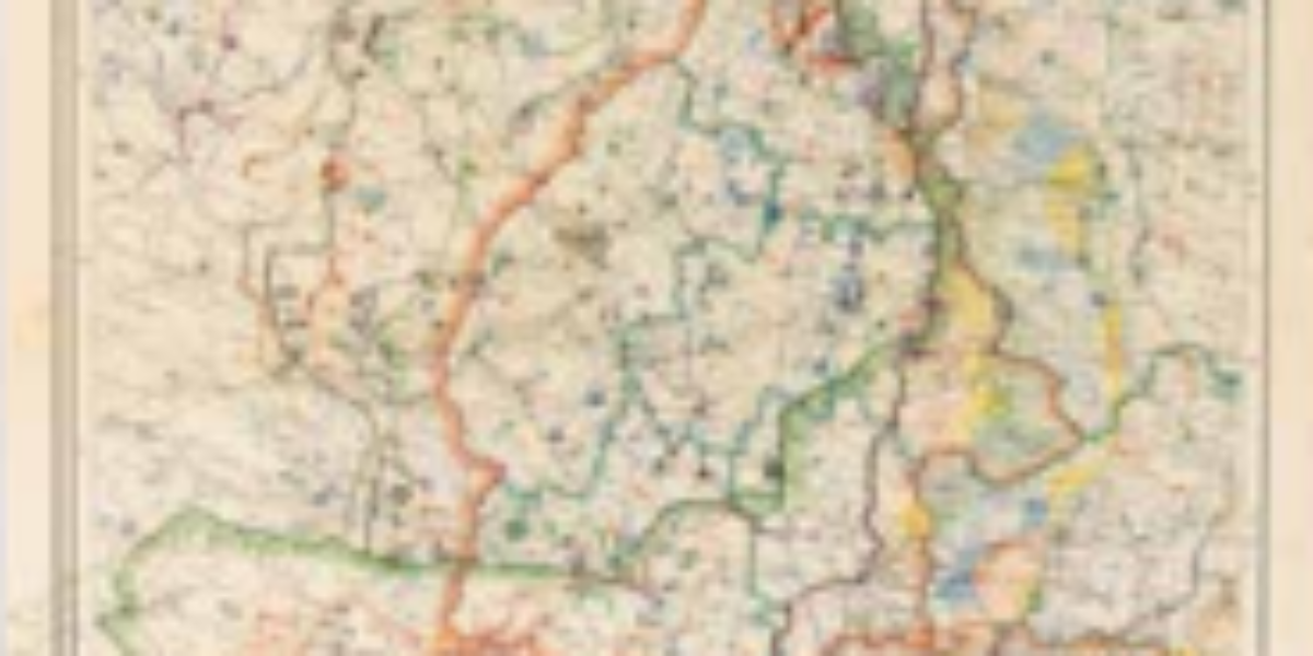
During the mobilisation of 1939, every Dutch officer was issued a case of maps covering the entire Netherlands at a scale of 1:50,000, with 1 cm on the map representing 500 m in the field. This scale was chosen because it allowed for all the necessary spatial details to be represented. However, these topographic maps were publicly available, resulting in the invading German forces also using them during their occupation of the Netherlands.
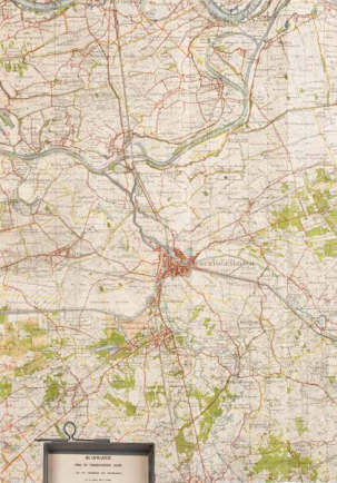
Topographische Inrichting, Topographische Kaart van Nederland, parts 1-62, sheet 43W 's-Hertogenbosch, The Hague 1939. Coll. S/T F.96, 50 x 40 cm.

Topographische Inrichting, Topographische Kaart van Nederland, volumes 1-62, metal case with other maps, The Hague 1939. Coll. S/T F.96, 54 x 18 cm.
More chapters
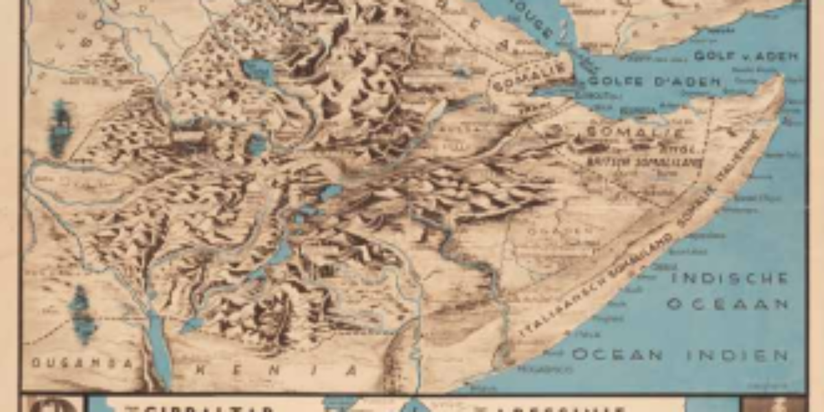
1. Abyssinia
Ethiopia: beginning of fascist imperialism Mussolini’s fascist regime seizes power in Italy in 1922, marking the start of an anti-democratic wave. This regime aimed to resurrect the concept of the Mare Nostrum, envisioning the Mediterranean Sea as an inland sea of a new Roman empire, as depicted in the second card. To prevent conflicts with…

2. SAAR 1
Saar German again: revenge on Versailles Following the end of World War I, Germany must make several concessions: ceding Alsace-Lorraine, accept the establishment of a large demilitarized zone in West Germany, and relinquish control of the new Saar sub-region to France. Just 15 years after the Treaty of Versailles, in 1933, after Adolf Hitler’s seizure…
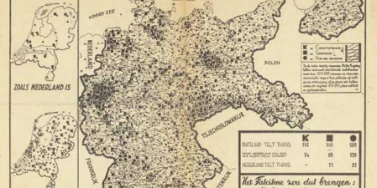
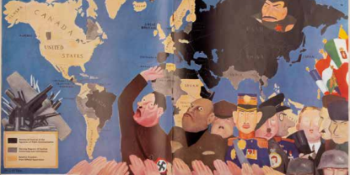
3. Where fascism rules
Dutch resistance to fascism In the Netherlands, the Social Democrats issued warnings about the repression occurring in concentration camps and prisons in Nazi Germany, cautioning that it could serve as a precursor if the National Socialist Movement were to gain power. At the time, there was already public awareness of the network of concentration camps….
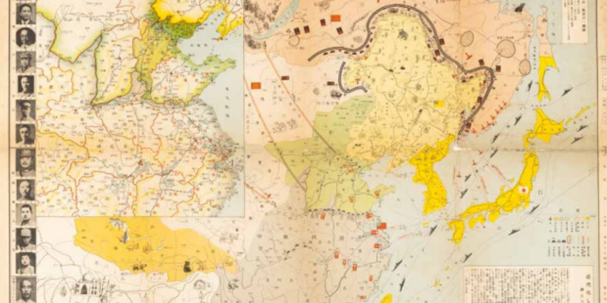
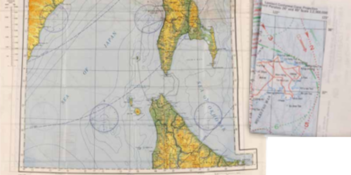
4. North China incident
Japan’s war of conquest in China This map illustrates the Japanese advance during the Second Sino-Japanese War (1937), referred to euphemistically as the “North China Incident” in Japan. However, the map is focused more on conveying the (unfounded) concerns of potential Soviet intervention in the conflict and possible air attacks on Japanese islands (indicated by…
5a,b. New black Plague
Left-wing America against encroaching fascism Ken was an American avant-garde magazine with a short-lived existence of a year and a half. This publication included Ernest Hemingway among its writers, and took a strong stance against what it viewed as the “enemies of freedom,” portraying these adversaries as a modern-day Black Death. This humorous cartoon illustrations…
6. Unserm Führer
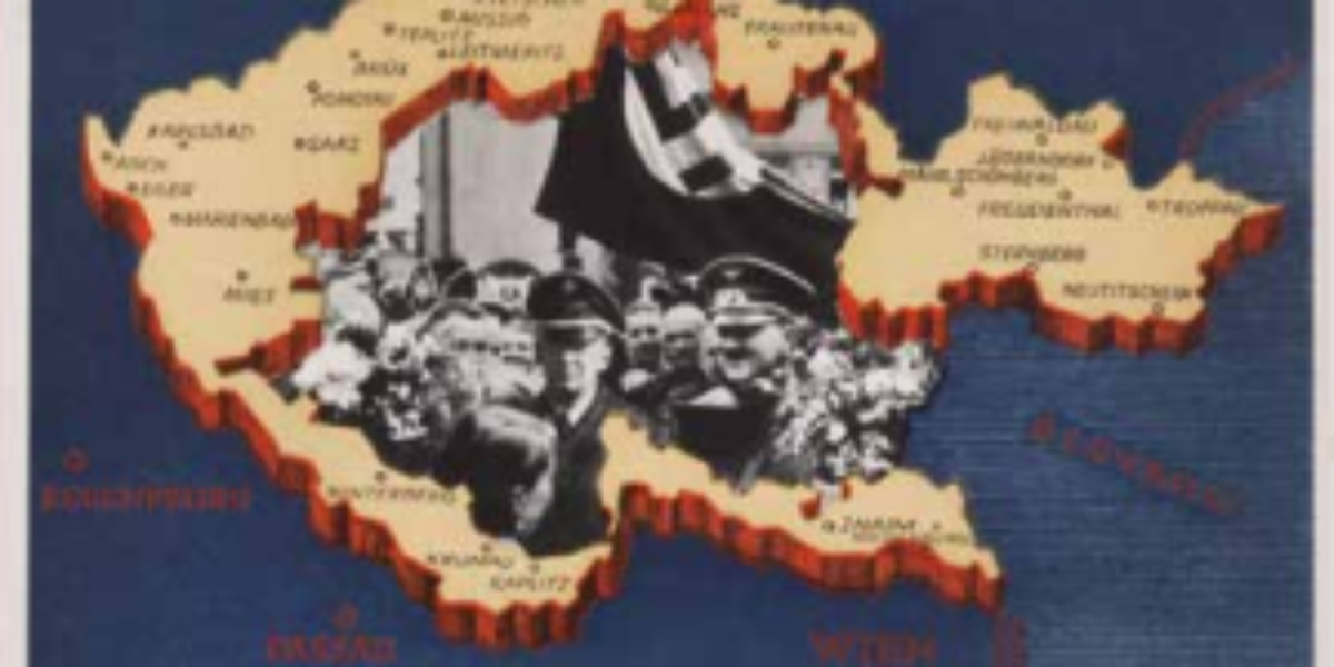
The ‘betrayal’ of Munich cashed in The “Anschluss” of Austria, which led to the region being referred to as the province of Ostmark within a newly expanded Großdeutschland, garnered significant approval from a majority of the population. Following this event, the “Führer” wastes no time – with the agreement of the British and French –…
8. Central Europe
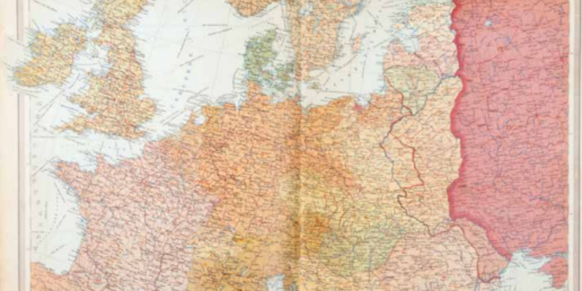
Molotov-Ribbentrop pact divides Poland On August 23, 1939, the foreign ministers of Nazi Germany, Von Ribbentrop, and the Soviet Union, Molotov, signed a nonaggression treaty in Moscow. However, a secret protocol was added in which the two powers had already divided East Central Europe into their respective spheres of influence. As seen on this map,…
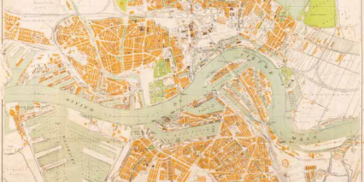
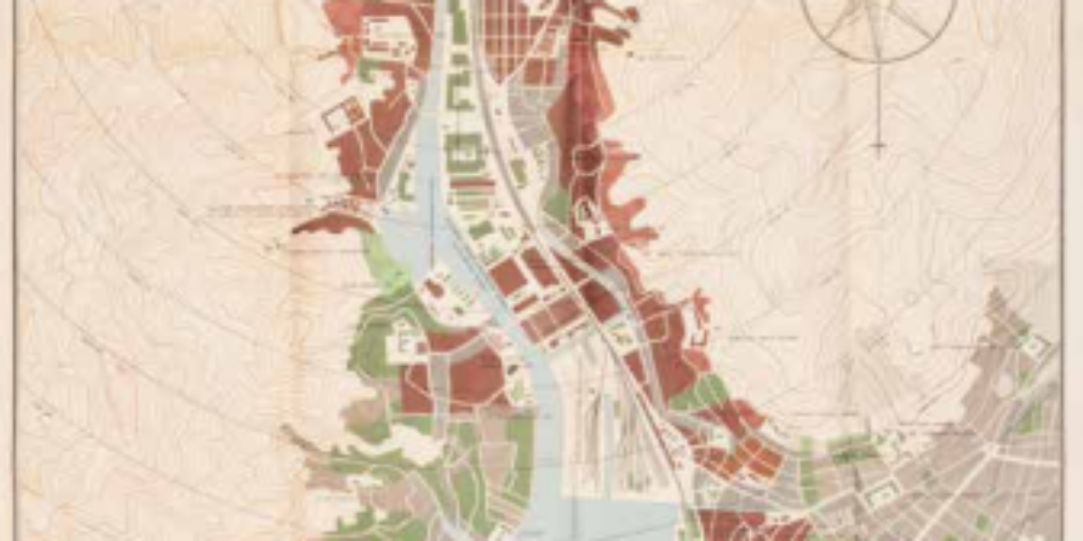
9. Compass of Rotterdam
Bombardment as basis for modernization This is the first map published of Rotterdam shortly after the devastating terror bombing that occurred on May 14, 1940, resulting in the complete destruction of the city centre. The scale of the devastation is extensive, yet despite the destruction, many buildings are left standing, only to disappear at a…
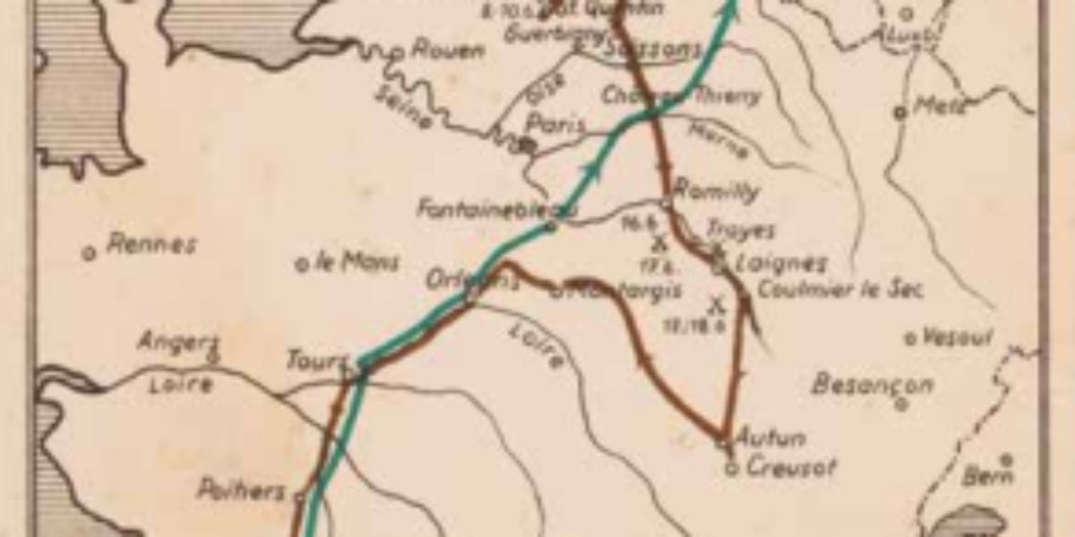
10a,b,c,d. Der Siegeszug
Flash war waltzes over Western Europe The divisions detailed on this map signify the rapid conquest of not only the Netherlands but also Luxembourg and Belgium. France is also depicted as facing a swift defeat. According to German propaganda, this march is highlighted in Map 10d, with an emphasis on the cooperation between infantry, tanks,…
11. Camps de Prisonniers
French prisoners of war in Greater Germany The legend accompanying this map notes that there are 47 Oflags (Offizierslager, designated for officers) and 60 Stalags (Stammlager, for non-commissioned officers and soldiers). Yet the map lists many more camp names than indicated in the legend, and conversely, some camp names mentioned in the legend are not…
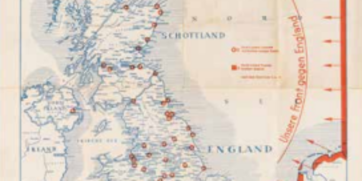
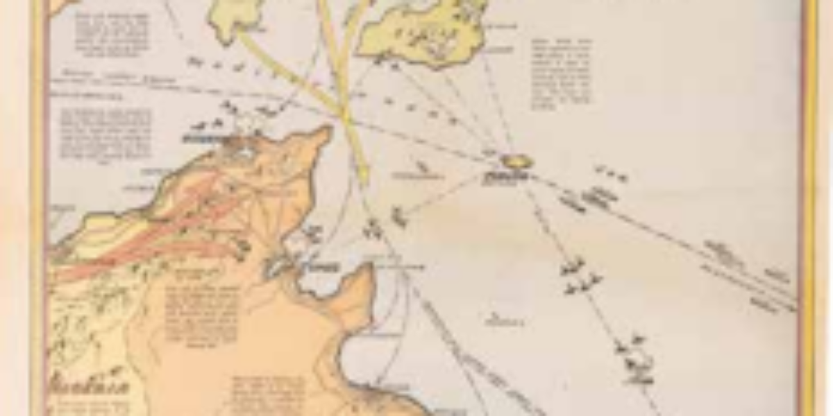
12. Die Große Englandkarte
Air Battle for Britain By the time this map was published in April 1941, the planned amphibious assault on England had already been cancelled. Although the map’s red arrows suggest a dominant German advance, by this time the Luftwaffe had also suffered heavy losses in the air war, due to the intense bombing of major…
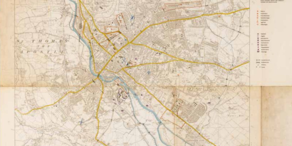
13. Stadtplan Exeter
Air strike on Exeter The German army adopted this map from the British topographical service, the Ordnance Survey. The map highlights military-relevant objects such as barracks, ports, the power plant, bridges, and overpasses, and even the hospital. The navigator marks crosses where their bombs fall, but interestingly, none of the military objects are among the…
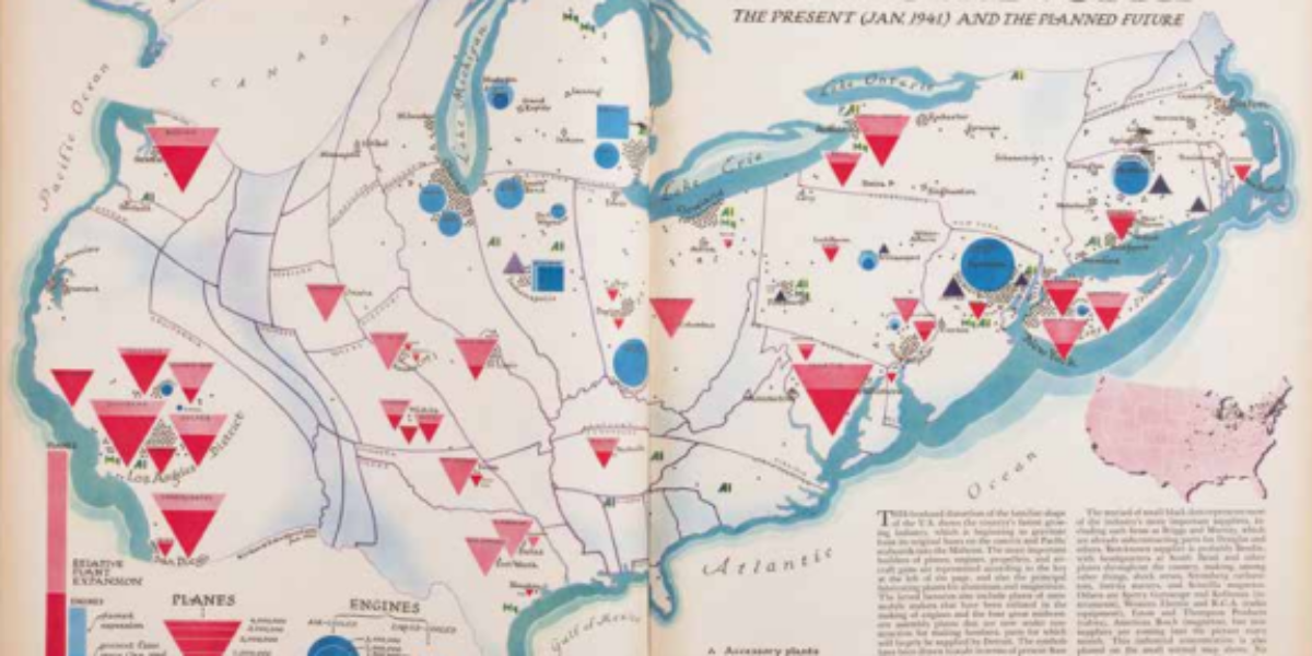
14. Air Industry
America’s war industry before the war In this modern map, the dimensions of each state are determined by their significance in the production process. The symbols’ sizes correspond to the scale of factories. This method of visualisation is groundbreaking, and for reference, Edes Harrison has included a “plain” map that displays all the establishment sites….
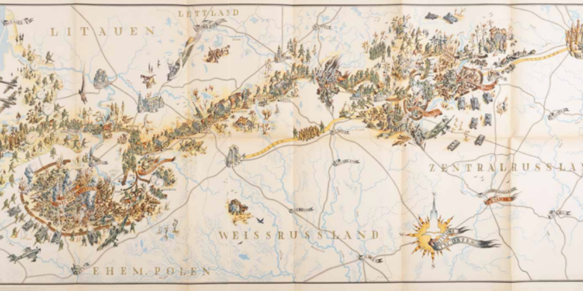
15. Infanterie-Division
Cheerful ‘Rollbahn’ to Moscow In January 1942, the Wehrmacht propaganda department authorises publication of this map and an accompanying book of photographs. The map has a cinematic, fresh, and cheerful appearance, but the consequences of the war on show are gruesome. During Operation Barbarossa, the Ulmer division advances to invade the Soviet Union, part of…
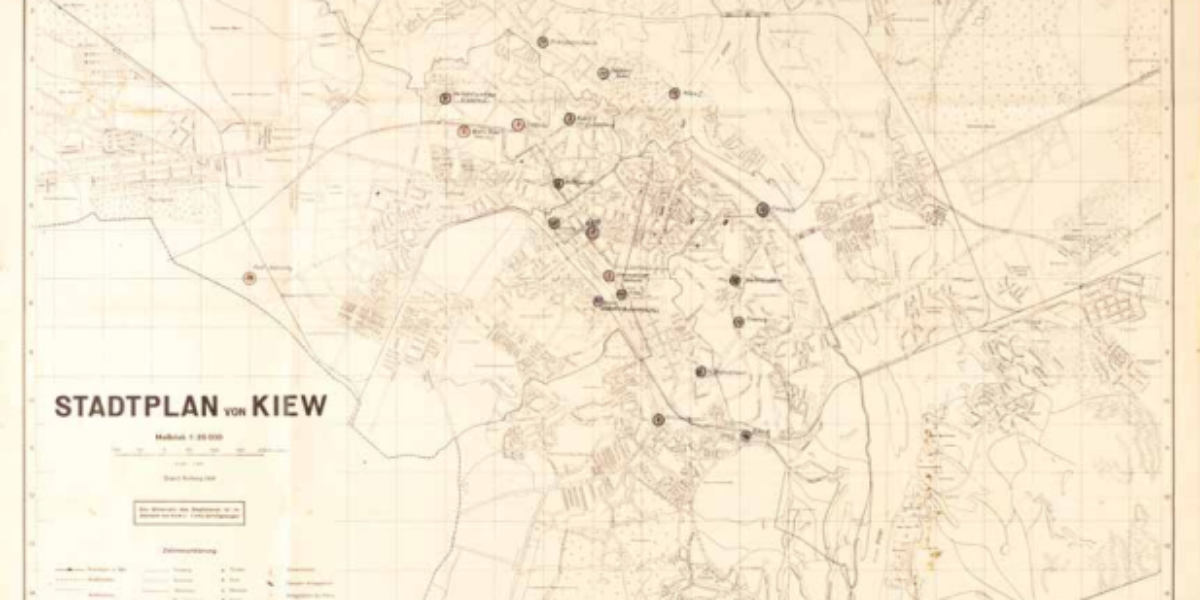
16. Stadtplan von Kiew
Sabotage and mass murder in Kiev On September 19, 1941, the Germans, with a force of 500,000 men, captured the city of Kiev/Kyiv following a 45-day siege. On September 24, the city centre, which had been mined by Soviet forces beforehand, including the army headquarters and Hotel Continental where German officers were staying (indicated by…
17. Stalingrad
Stalingrad: turning point in the war This map isn’t exclusively a military map, but it does contain (brief) military information. In late 1942, Italian, Hungarian, and Romanian flank troops deserted, but the 6th German Army was ordered not to withdraw from Stalingrad; the city and its name are symbolicaly significant. After months of intense combat…
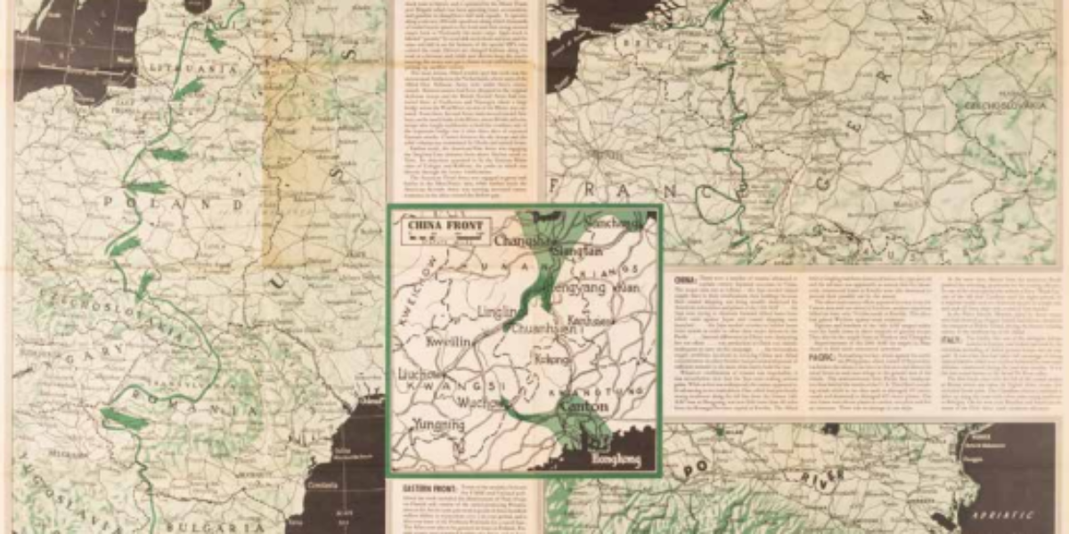
18. European Soviet Union
Nazi Germany loses on eastern fronts The printed background of this map provides a fairly accurate, though small-scale (1:1,500,000, 1 cm on the map representing 15 km in the field) representation of the European Soviet Union. We are focused on just three western sheets of the map, where a previous owner has inscribed in coloured…
19a,b. North Africa
Newspaper map as informational propaganda As the tide of the war turns, the American home front receives increasingly enthusiastic maps. Charles Owens contributes maps on a weekly basis to American newspapers. His maps exhibit a style reminiscent of Hollywood movies and comic books. They feature a unique perspective with the earth depicted in a convex…
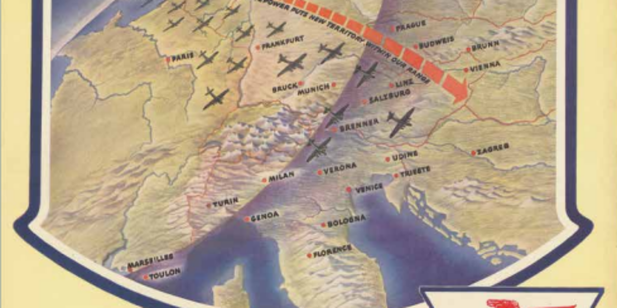
20. Zone of Destruction
War success as publicity War has always acted as a catalyst for technological innovation. With this in mind, the US developed a more efficient fuel that enhances flying range. This ‘super fuel’ has a higher octane rating, which means greater ‘flying horsepower’, speed and payload and increased range, without requiring a more powerful engine. B17s,…
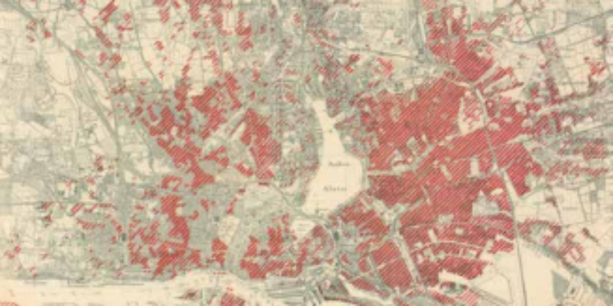
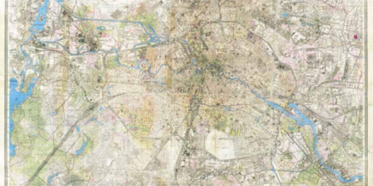
21. Hansestadt Hamburg
British terror bombing of Hamburg The British bombing of Hamburg during Operation Gomorrah in late July and early August 1943 created a massive firestorm that resulted in over 30,000 civilian deaths. The extensive material destruction is depicted in this accurate Nazi map. In Hamburg East in particular, an area spanning eight by four square kilometres,…
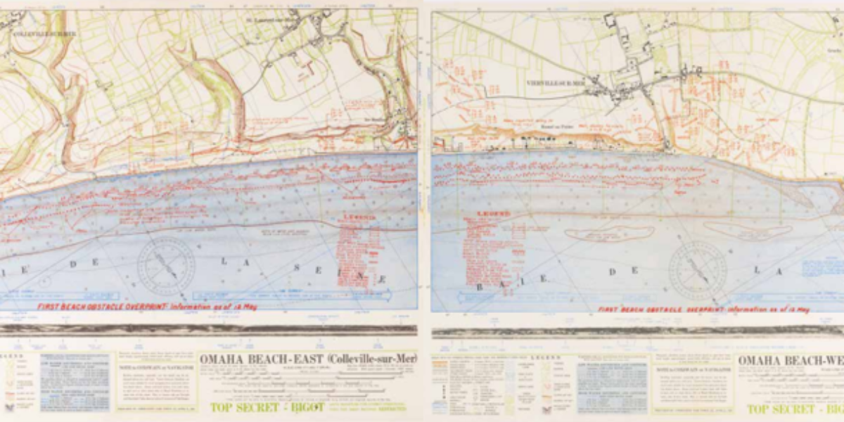
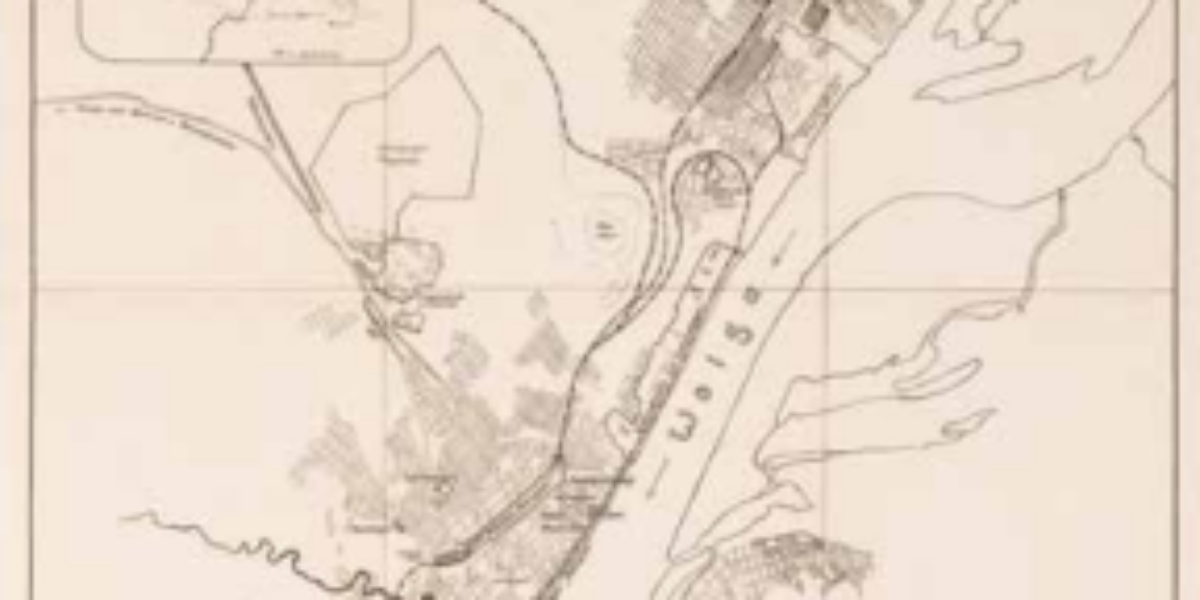
22. Omaha Beach
D-day: Atlantic Wall breached Just as travellers in a car hold a map in the direction they are headed, this map is oriented toward the beach, which is to the south. Based on intelligence efforts, the troops are aware of the obstacles they will encounter both on the way to the beach and on the…
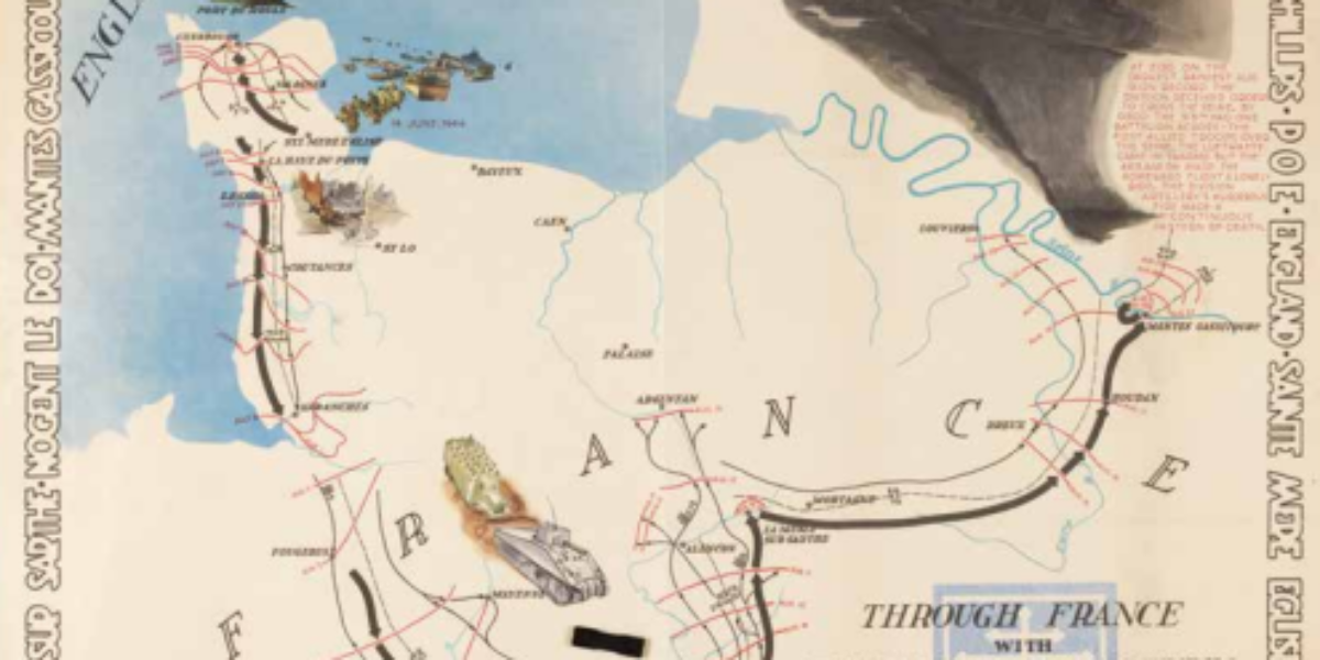
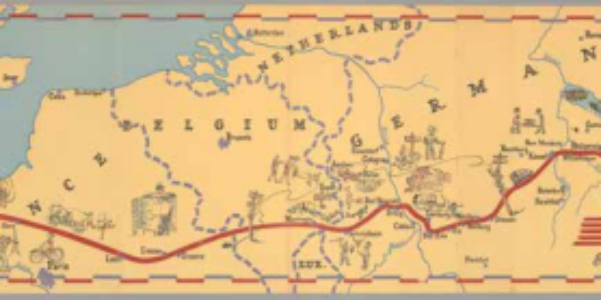
23. 79th Division
Hollywood-inspired ‘debriefing map’ Four large sheets depict a US division’s participation in the Allied advance following D Day. The beautifully designed frame tells the story of the 79th division. This starts at training camps in the United States and England and depicts each of the places the division passes through. In addition, special actions are…
24. NEWSMAP
News of victories for own troops Every week, the U.S. military produces a poster-sized news map, featuring action arrows and explanatory notes. These maps are not intended for the general public but are distributed to military personnel worldwide, government officials, select libraries, and a single copy is provided to the U.S. House of Representatives. These…
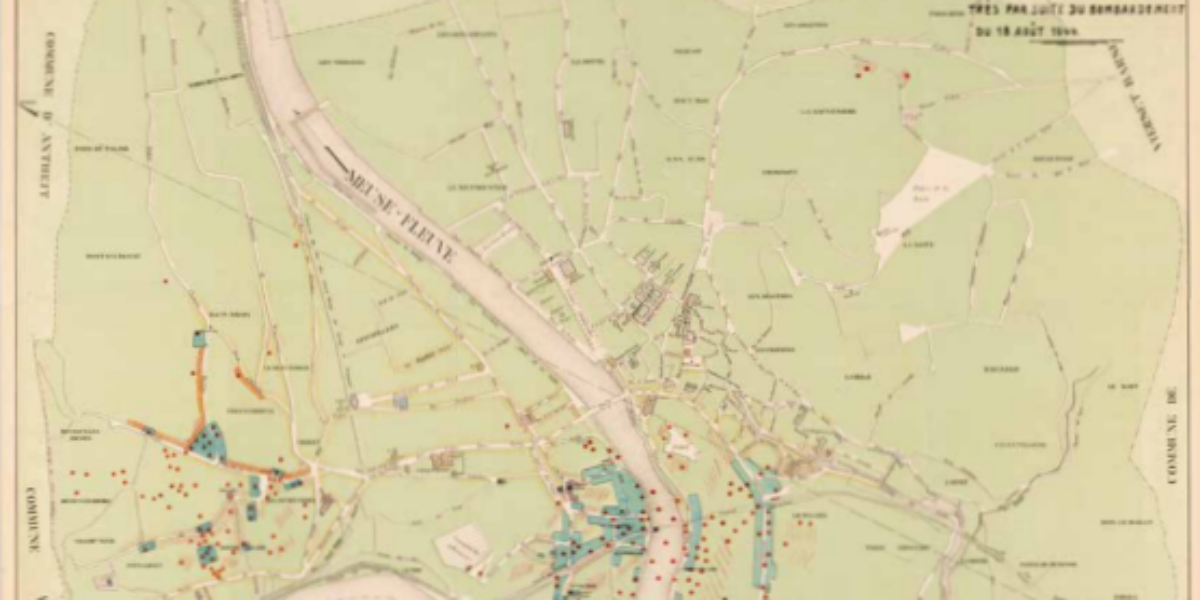
25. Plan de la ville de Huy
The price of rapid advance: Huy devastated On August 18, allied forces launched an aerial bombardment targeting the Meuse River bridges in Belgium. The bombing mission involved “flying fortresses” dropping bombs on multiple locations, including Huy, which is situated south of Liège. Unfortunately, most of the bombs do not hit the intended targets (except for…
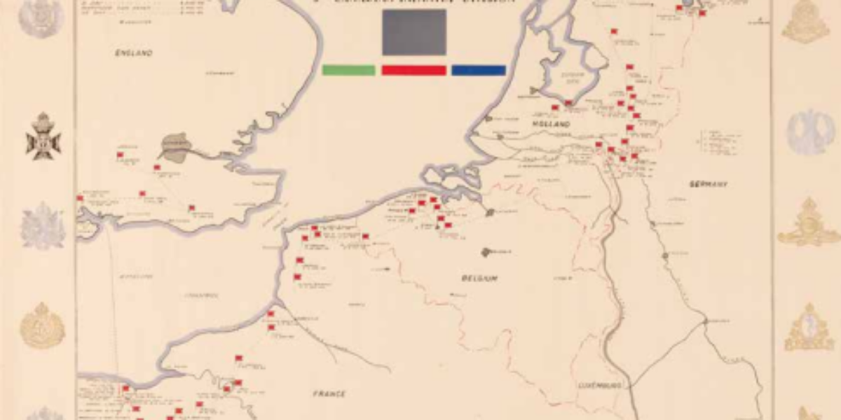
26. Canadian Infantry
Canada liberates eastern and northern Netherlands In contrast to the style of the U.S. 79th Division’s memorial map, this Canadian map of their 3rd Division takes on a more formal and sombre appearance. Fags and dates indicate the shifting locations where the division headquarters was situated during its campaigns. The map highlights the strategic positioning…
27. East meets West
Endless internment in Bandung Shortly after the Allied capitulation in March 1942, Japan interned all Europeans in Indonesia. Men, women with small children, and teenage boys, were all placed in separate camps. Notably, the men’s camp, the boys’ camp, and the women’s camp were situated in close proximity to each other. The internment camps were…
28. Берлин (Berlin)
Destruction and fall of Berlin This extensively restored working copy belonged to Major General Safaryan, commander of the 89th Armenian Infantry Division, and is part of his estate. The map shows the division’s progress during the Battle of Berlin in April 1945. The division attacks from the north (Wilhelmsruh) and is the second division to…
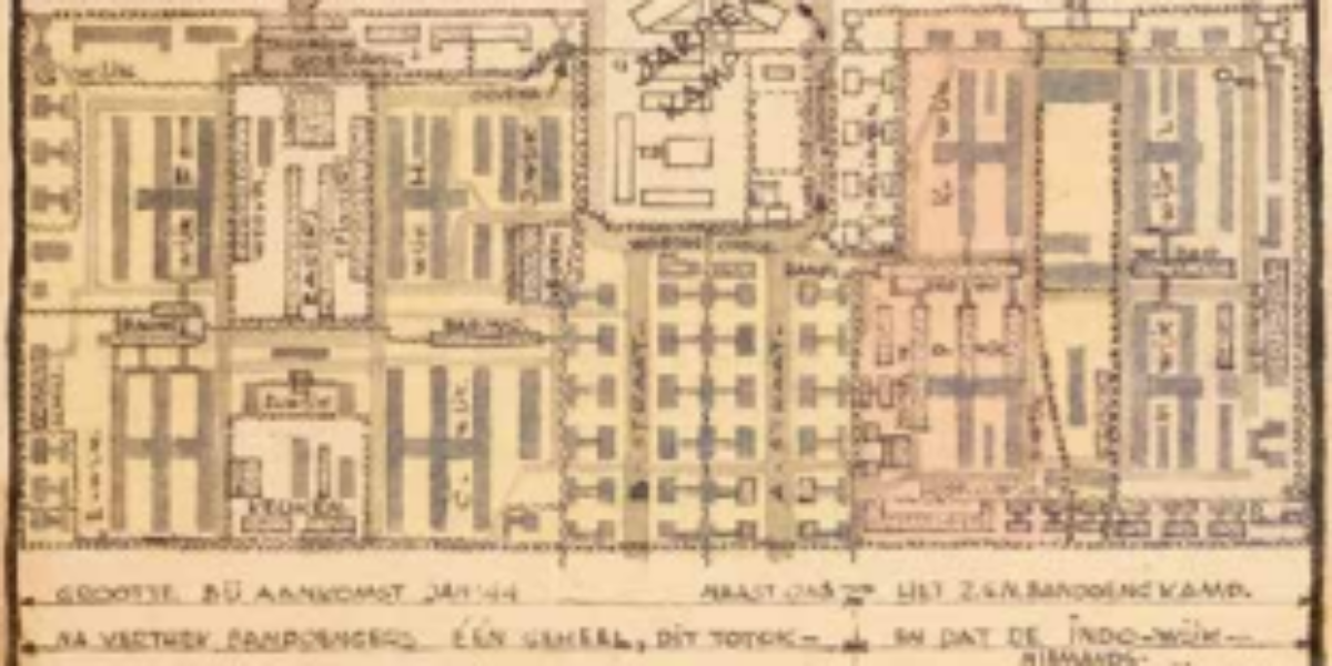
29a,b. Camps in Bandung
Endless internment in Bandung Shortly after the Allied capitulation in March 1942, Japan interned all Europeans in Indonesia. Men, women with small children, and teenage boys, were all placed in separate camps. Notably, the men’s camp, the boys’ camp, and the women’s camp were situated in close proximity to each other. The internment camps were…
30a,b. AAF Cloth Chart
Escape maps for pilots These “escape maps” printed on artificial silk were initially kept as a secret. They served a crucial purpose for American pilots who might be shot down over the sea or enemy territory. If a pilot managed to save himself by parachuting to safety, these maps provided a valuable means of orientation….
31. Bomb Damage Nagasaki
Second atomic bomb destroys Nagasaki This sober report analyses the effect of the atomic bombs on Hiroshima and Nagasaki (6 and 9 August 1945) compared to ‘ordinary’ bombings of other Japanese cities. ‘Nagasaki’ was less effective than ‘Hiroshima’ due to the hilly terrain, but the overall effect turned out to be greater, owing to the…