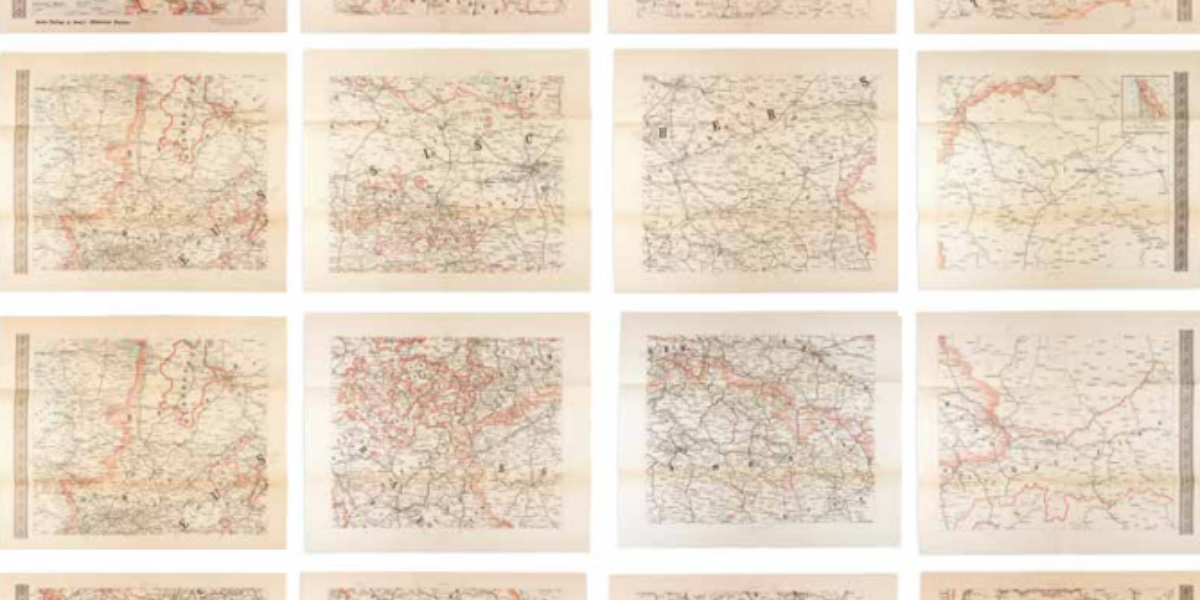
Map of Hell at Passchendaele
In October 1917, new attacks in the direction of Passchendaele are prepared as Canadian, Australian and New Zealand troops reinforce the British army. The artillery is tasked with to eliminating obstacles and enemy soldiers, while firing over the heads of its own side’s infantry. All the infantry subsequently needs to do is occupy ravaged territory. Starting and stopping these attacks needs to be synchronised all along the lines, otherwise the artillery will mainly eliminate its own troops. The map (1:10,000) shows that this process needs to be repeated every 70 metres. On 12 and 22 October, such an attack was launched. When downpours erupt, cannons, soldiers and supplies are moved forward over boards. Criticism to the effect that this tactic means thousands of casualties without any real territorial gain is parried by General Haig who (incorrectly!) claims that German losses exceed British losses by 100%. What was once Passchendaele is taken on November 6; taking eighty square kilometres of hardfought mud has demanded more than half a million dead, missing, and seriously injured.
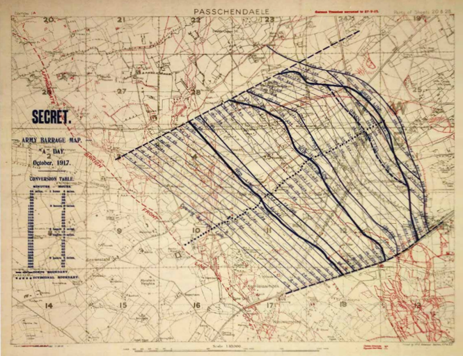
General Staff, Geographical Section, Passchendaele. Secret. Army Barrage Map, ‘A’ Day, October 1917, London 2022 (facsimile). Coll. S/T Y.1a.23, 41 x 61,5 cm.
More chapters
1. Carte comparative
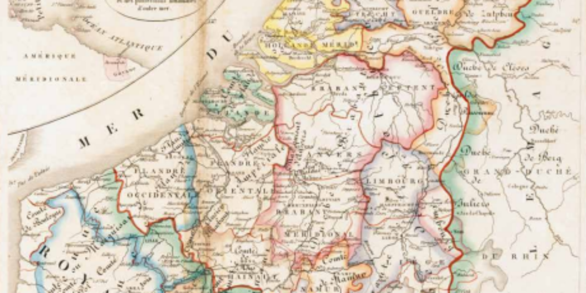
Belgium and the Netherlands For centuries, ‘the Netherlands’ and ‘the Low Countries’ have served as Germanic equivalents for the Romanesque ‘Belgica’ or ‘Belgique’ and ‘Pays-Bas.’ In this 1837 map, which is identical to the 1827 version, this linguistic detail remains intact. However, there is a small inset map at the top left that acknowledges the…
2. Kingdom of the Netherlands
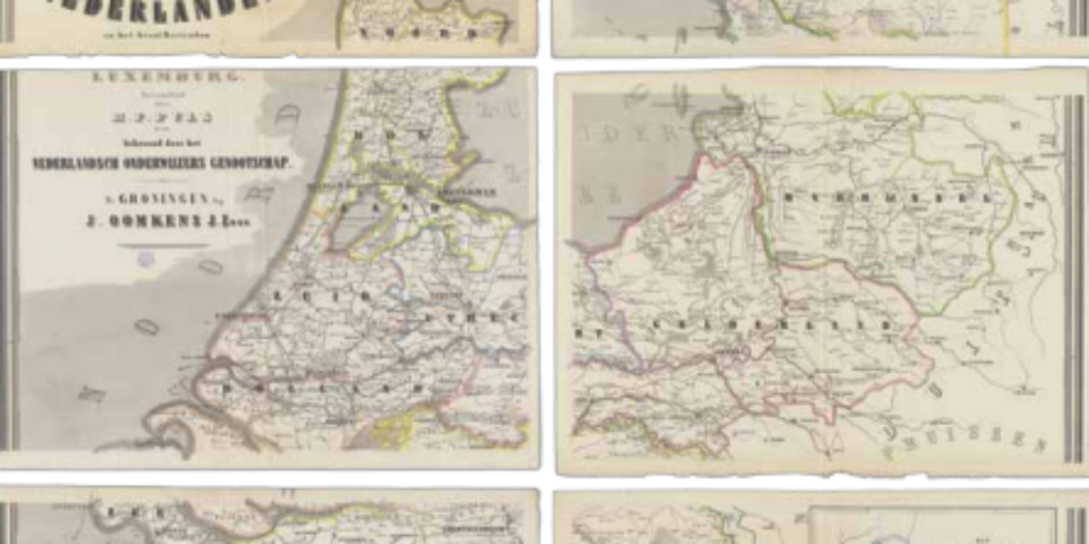
Wall map of the Kingdom During the mid-19th century, the wall map made its appearance in the classroom. These hand-coloured maps depict 11 provinces, complete with the provincial and district capitals, smaller towns, villages, hamlets, as well as the country’s network of waterways and railways. The map also displays the Dutch colonies and the Grand…
3. Schoolkaart
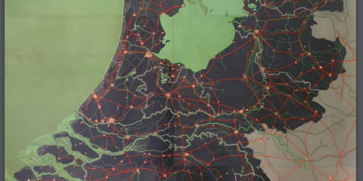
Schoolwandkaart van Nederland At the end of the 19th century, the development of lithography makes it possible to print coloured surfaces. On this school map by head teacher C.A.C. Kruyder from Zwolle, the sea is green, and the land is black. The dark, ominous look of this wall map is illuminated to some extent by…
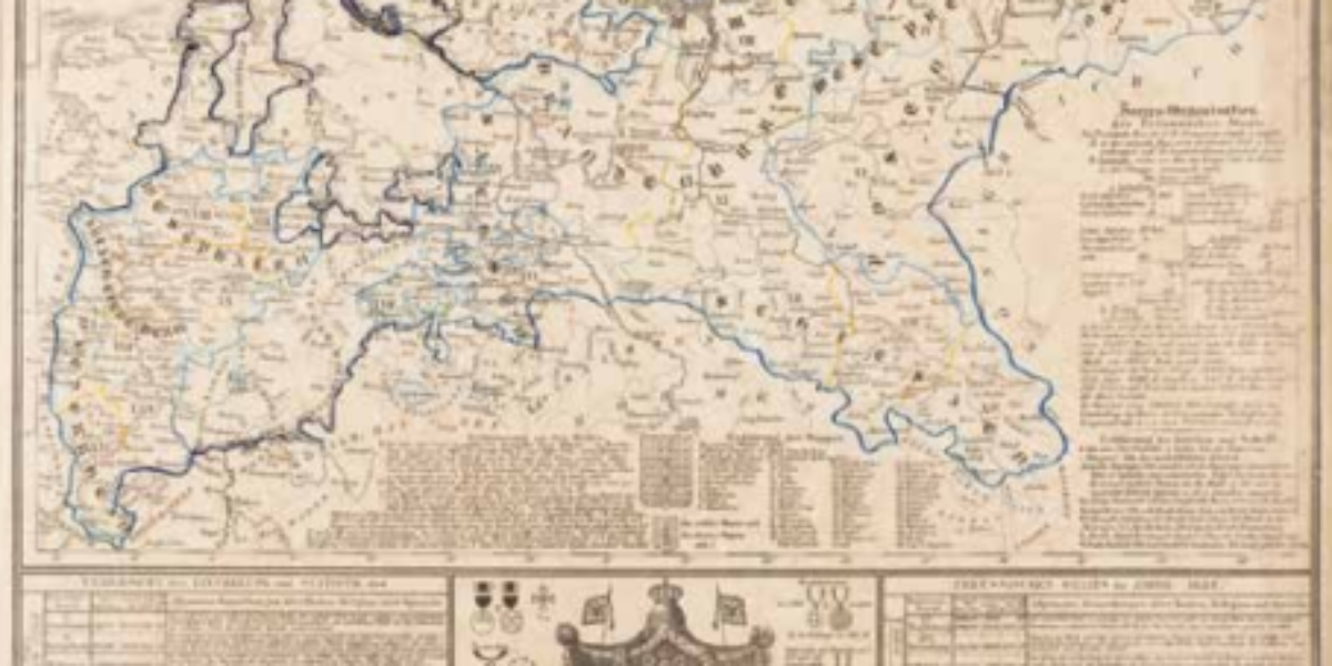
4a,b. Preussen-Atlas
Kingdom of Prussia Framed within light blue borders, this survey map featured in the Atlas des Königreichs Preussen provides a representation of the Prussian Empire following the Congress of Vienna in 1815. This map illustrates how Prussia extended its territorial control over large portions of western Germany during this period. To avoid any potential confusion,…
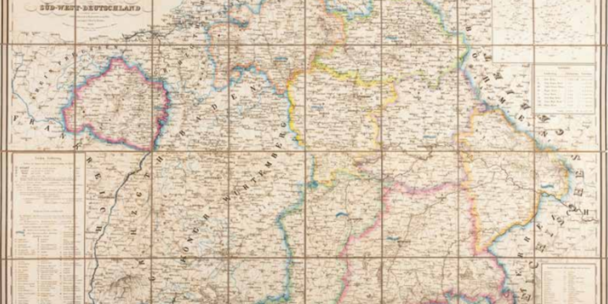
5. Königreiche Bayern
Kingdom of Bavaria This modern statistical map shows highlights of various districts, along with their respective administrative and military capitals. However, it places the capital Munich at the forefront by giving it the most authority symbols. In doing so, this practical map promotes Bavarians to identify with the new kingdom, underscoring the modern administrative structure…
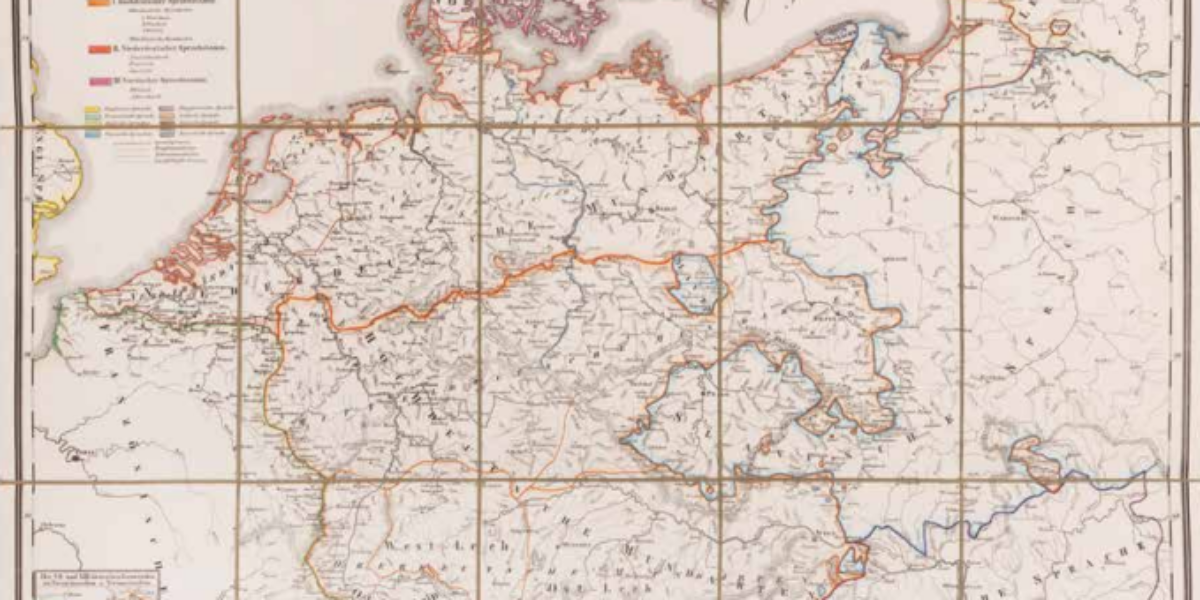
6. Sprachkarte von Deutschland
Language map of Germany In 1834, Karl Bernhardi, librarian in Kassel, suggests the creation of a language map of the German nation to national historical societies. In romantic nationalism, a people’s history largely determines the development of their national consciousness, and cultural unity can be seen in a common language more than anything else. After…
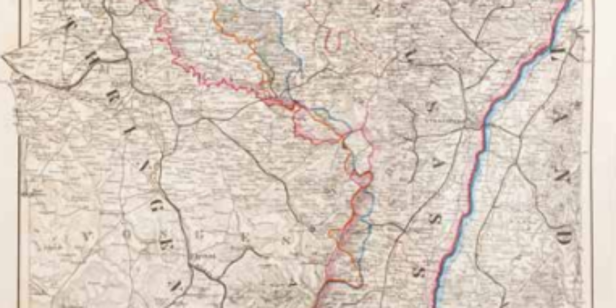
7. General-Gouvernement Elsass
German-French language border in Alsace This map demarcates regions where German or French is the predominant mother tongue while also highlighting mixed intermediate areas. The map serves to legitimize the annexation of Alsace by Bismarck and the German states on this basis of ‘linguistic human rights’.
8. Burau-Karte
Office map of the German Empire This wall map, consisting of sixteen free supplements to Henzes Illustriertem Anzeiger, offers a portrayal of the German Empire as it was established within the hall of mirrors at Versailles in January 1871. However, the map also caters to liberal circles by placing emphasis on industry and trade.
9. Fremde Volksstämme
Strange tribes in the German Empire The geographer and cartographer Paul Langhans is recognized as a pioneer in the discipline of ethnocentric geopolitics. This map differentiates regions by the dominant language spoken, with a secondary distinction marking different religions, presenting Protestant areas in a bright color and Catholic regions in a grayish one. Non-German-speaking majorities,…
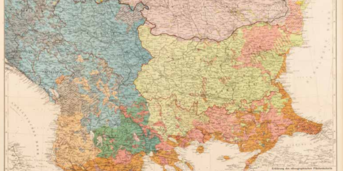
10. Karte der Balkanhalbinsel
Ethnographic map of the Balkans Ethnographic maps of the Balkans show significant differences, depending on the maker and the country of origin. The choice of relevant language data (mother tongue, school language, church language, market language or official language) depends on the territorial claims that might be legitimized in this way. Especially around Ottoman Macedonia,…
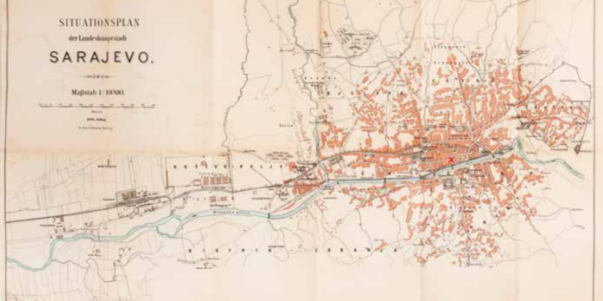
11. Situationsplan Sarajevo
Map of Sarajevo World War I marked the end of a relatively stable period in Europe. This map of Sarajevo features a prominent red X, marking the precise location where Bosnian Serb Gavrilo Princip carried out his fateful assassination of Archduke Franz Ferdinand and his wife Sophie on June 28, 1914. A month later, Austria-Hungary…

12. Belgien
Belgium in 1914 This military survey map, accompanied by annotations detailing the movements of advancing German troops, highlights the military significance of the forts surrounding Antwerp, Namur, and Liège in Belgium. It reflects a pivotal moment where Belgium is defeated with the exception of the Westhoek region near the Yser River.
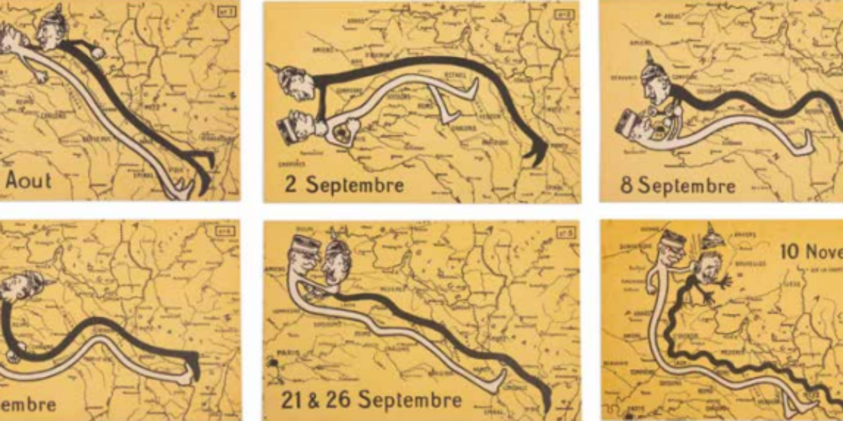
13. l’Attaque
Stalling motion war These postcards offer a perspective on the elongation of the front and the stalemate that characterized the German War of Movement in northern France in 1914. In a somewhat satirical manner, these postcards depict Kaiser Wilhelm and French commander-in-chief Joffre engaging in fistfights to represent the various battles.
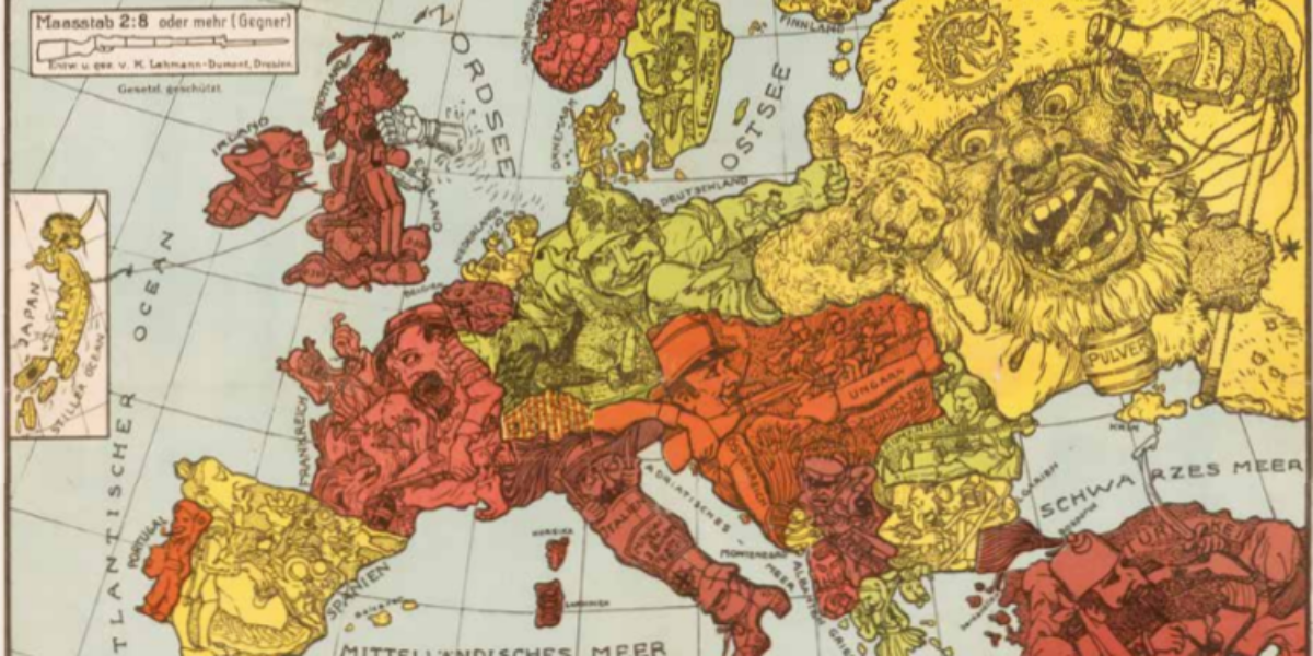
14. Humoristische Karte
German propaganda card 1914 This intricate German propaganda map, produced in late 1914, offers a lighthearted and caricatured depiction of the early stages of World War I in Europe. However, the amusement derived from such cartoon maps would soon fade.
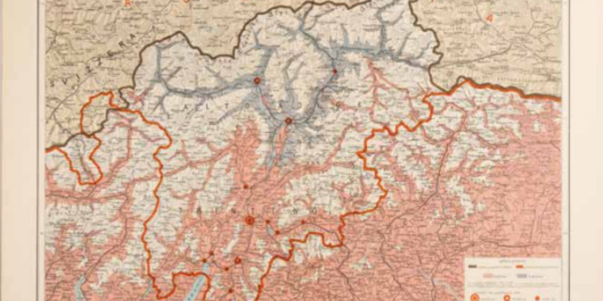
15a,b. Venezia Tridentina
South Tyrol or Alto Adige This ethno-linguistic map serves as a tool to legitimise Italian territorial claims to the area situated between their established (red) border and what is defined as the ‘natural’ (brown) border, running across the watershed. Within this region, the majority of the population is depicted as speaking Italian (highlighted in pink)….
16. So steht der Krieg!
This is how the war stands The pamphlet cards titled ‘This is the state of the war,’ are issued every two weeks by order of the German army. The front side of this particular card from late July 1915 contains reports on recent fighting both on the western front and the eastern front. The course…
17. Belgium
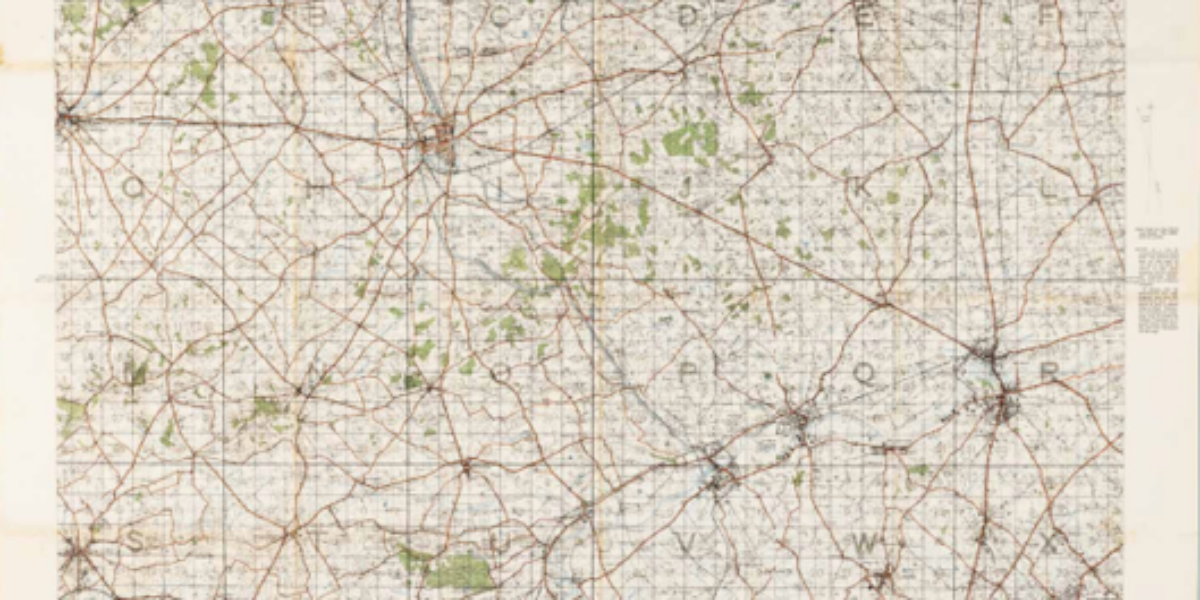
Blowing up hilltops below Ypres In this overview map, scaled at 1:40,000, Ypres takes a central position, with the village of Passchendaele situated to the northeast of the front city. This map highlights when the British army initiated a successful assault on the ridge located to the south of Ypres, which provided the German artillery…
18. Waterdamhoek
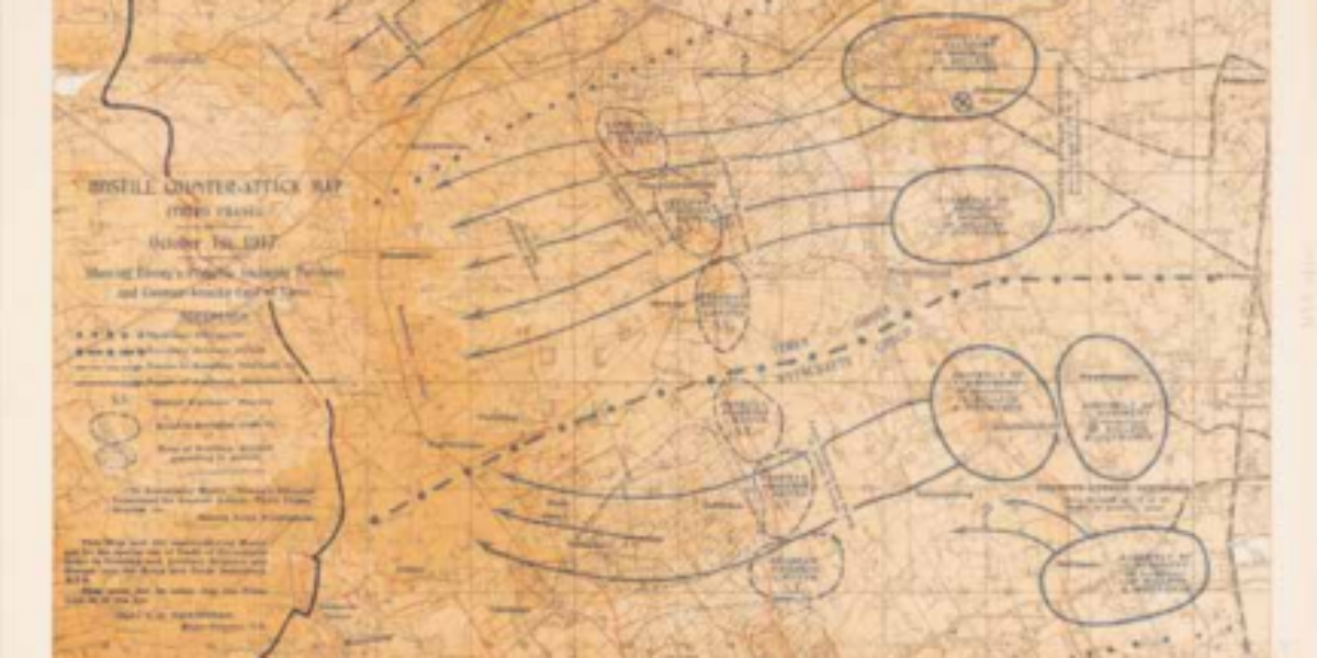
Map of expected counter-attack This map, scaled at 1:20,000, is used by British officers as they assess potential scenarios for a German counter-offensive on October 1, 1917. It marks trenches and fortified posts in red, while Passchendaele is prominently featured at the top, in the centre of the map.
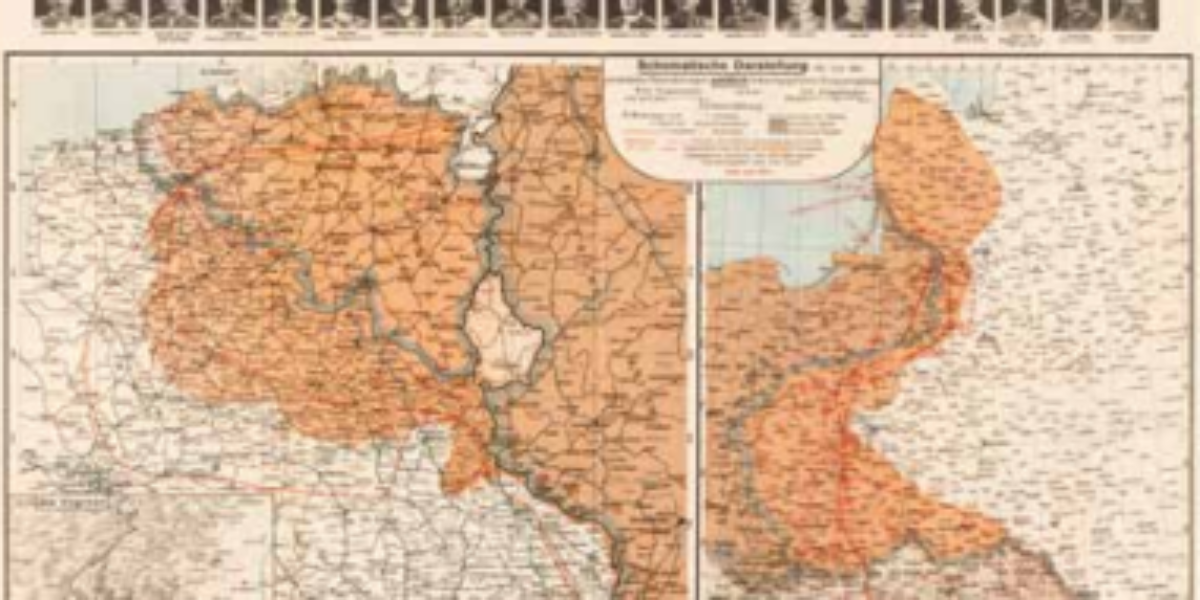
20. Plan Directeur Ypres
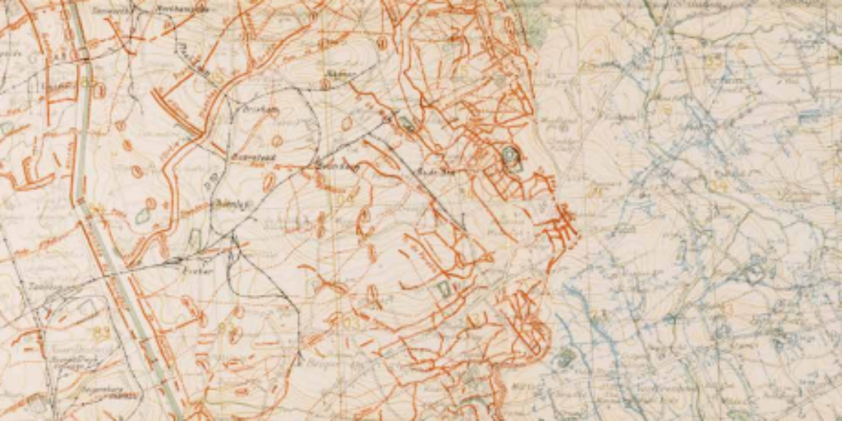
Allied and German trenches This secret map (1:20,000) from September 1918 is overlaid with German (blue) and allied (red) trenches and therefore it may not be used at the front. When Germany cleared fifty Eastern Front divisions after the Russian revolution and rapidly moved them to the Western Front, General Ludendorff managed to conquer large…
21. German Alliance
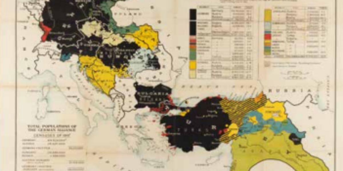
Self-determination of peoples This propaganda map, which emerged in London, is a response to US President Wilson’s plan. In Versailles, President Wilson advocates for a rearrangement of the map of Europe based on the principle of self-determination of peoples within the tyrannical superpowers of Central Europe and the Middle East.
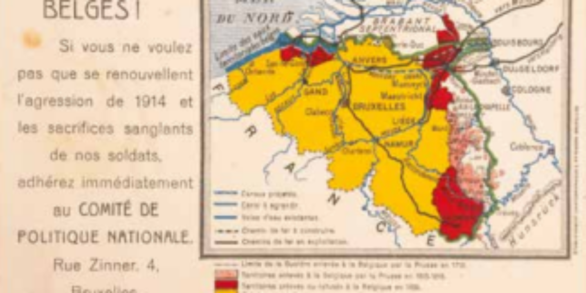
22. Belges!
Claims of Greater Belgium The ‘Comité de Politique Nationale’ advocated for the concept of Greater Belgium, which aimed to annex several territories that had once belonged to the Southern Netherlands but had been under Prussian control for two centuries. Additionally, their vision included the return of Luxembourg, Dutch-Limburg, and Zeeuws-Vlaanderen to Belgian sovereignty. However,…
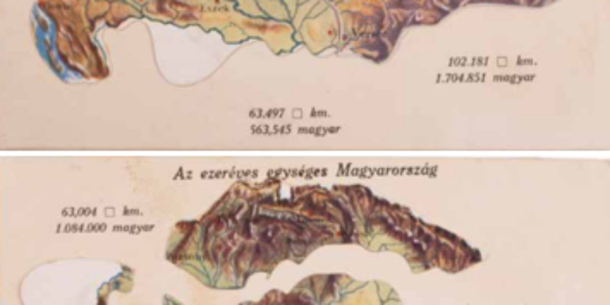
23. Az ezeréves Magyarország
Hungary falls apart The movable postcard titled ‘Thousand-Year-Old Hungary’ represents the grief surrounding the dissolution of the Austro-Hungarian Empire following World War I. This traumatic historical event continues to resonate deeply in the collective memory of Hungary.
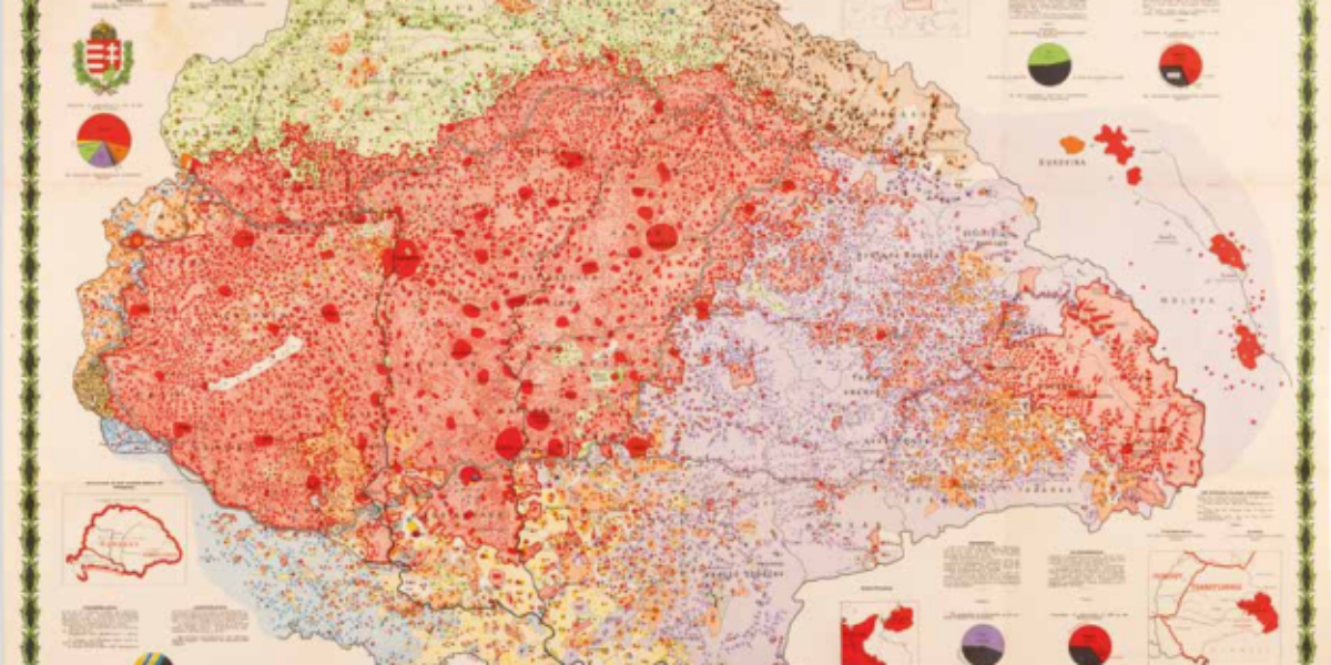
24. Ethnographic map Hungary
Ethnographic map of Greater Hungary This ethnographic map of Greater Hungary was designed by Károly Kogutowicz, a geography professor in Budapest. The primary criterion for classification on this map is the language that people speak most fluently. It not only delineates areas where specific languages are spoken but also highlights population density, using colour intensity…